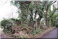
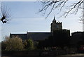
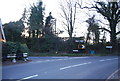
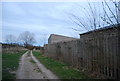
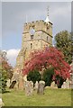
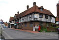
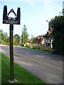
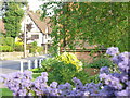
Area Overview for Brenchley
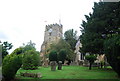
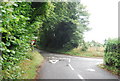
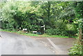
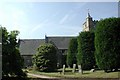
Photos of Brenchley
Area Information
Brenchley is a compact built-up area spanning 72.3 hectares, offering a quiet, community-focused environment in England. With a median age of 70, it is a mature demographic, suggesting a population of long-term residents rather than a rapidly growing town. The area is well-served by nearby amenities, including five retail outlets such as M&S Blue Boys Tonbridge BP, Tesco Paddock, and Waitrose Paddock, ensuring daily needs are met without long commutes. Rail connectivity is strong, with five nearby stations including Paddock Wood and Marden, facilitating travel to larger towns. Brenchley’s character is defined by its accessibility to both local services and regional transport, making it suitable for those prioritising convenience and a slower pace of life. The presence of two primary schools, Brenchley and Matfield Church of England Voluntary Aided Primary School and Brenchley and Matfield Church of England Primary School, underscores its appeal to families. For those considering living in Brenchley, the balance of practical amenities and a stable community makes it a compelling choice.
- Area Type
- Built Up Area 250
- Area Size
- 72.3 hectares
- Population
- Not available
- Population Density
- Not available
Daily life in Brenchley is shaped by its proximity to practical amenities. The retail options include M&S Blue Boys Tonbridge BP, Tesco Paddock, and Waitrose Paddock, offering a range of shopping and dining choices within easy reach. These stores cater to both everyday needs and occasional indulgences. Rail stations like Paddock Wood and Marden provide access to broader networks, enabling travel to nearby towns for work, leisure, or socialising. While the area lacks large parks or leisure facilities, the retail and transport options contribute to a convenient lifestyle. The presence of two primary schools ensures families have access to education, while the mature demographic suggests a community centred on stability and local connections.
Amenities
Schools
Brenchley is served by two primary schools: Brenchley and Matfield Church of England Voluntary Aided Primary School and Brenchley and Matfield Church of England Primary School. Both are primary institutions, catering to younger children in the local area. The presence of two schools provides families with options, though the data does not include Ofsted ratings or academic performance details. For parents seeking primary education for their children, these schools are the primary local resources. The lack of secondary schools in the immediate vicinity may require families to consider commuting to nearby towns for higher education. The availability of two primary schools suggests a focus on early education within the community, supporting families with young children.
| Rank | A + A* % | School | Type | Entry gender | Ages |
|---|---|---|---|---|---|
| 1 | N/A | Brenchley and Matfield Church of England Voluntary Aided Primary School | primary | N/A | N/A |
| 2 | N/A | Brenchley and Matfield Church of England Primary School | primary | N/A | N/A |
Explore more schools in this area
Go to Schools tabDemographics
The population of Brenchley has a median age of 70, indicating a community skewed towards older residents. This suggests a demographic where retirement or long-term settlement is common, with fewer younger families or working-age adults. Home ownership in the area is high at 80%, reflecting a strong presence of owner-occupied properties. While the data does not specify household composition or accommodation types, the high home ownership rate implies a stable, settled population. The absence of detailed information on ethnic groups or religious affiliations means the area’s diversity cannot be quantified, but the overall profile points to a mature, low-turnover community. For those considering Brenchley, this demographic structure may influence local services and amenities, tailored to the needs of an older population.
Household Size
Accommodation Type
Tenure
Ethnic Group
Religion
Household Composition
Age
Household Deprivation
NS-SEC
Explore more demographic insights in this area
Go to Demographics tabPlanning
Planning Constraints
- Crime RiskLocked