Area Overview for Breamore
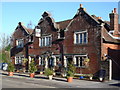
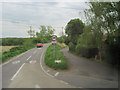
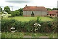
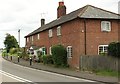
Photos of Breamore
Area Information
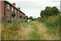
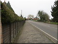
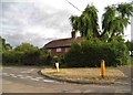
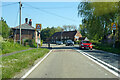
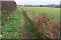
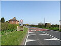
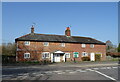
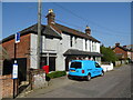
Breamore is a small built-up area in England, covering 20.8 hectares. Its compact size means it is not a sprawling suburb but a focused community with a distinct character. The median age of residents is 70, suggesting a population skewed towards older adults, which may influence the pace of daily life and local services. Living in Breamore offers a quiet, low-density environment, with homes likely to be older properties given the demographic profile. The area is served by Breamore Church of England Primary School, a good-rated institution that provides education for local children. While the area is small, it connects to nearby towns like Fordingbridge, where retail outlets such as Tesco and Co-op are accessible. For buyers, Breamore’s appeal lies in its safety, with a crime risk score of 85, and its proximity to essential amenities, though digital connectivity varies. This makes it a viable option for those seeking a tranquil, community-oriented place to live, though potential buyers should consider the broadband limitations.
- Area Type
- Built Up Area 250
- Area Size
- 20.8 hectares
- Population
- Not available
- Population Density
- Not available
Residents of Breamore have access to nearby amenities within practical reach, including five retail outlets. Notable stores include Tesco Fordingbridge, Co-op Fordingbridge, and Co-op Downton, which provide essential shopping options for groceries and household items. These stores are likely located in Fordingbridge, a nearby town, making them accessible by short drives or public transport. The presence of multiple Co-ops suggests a focus on affordable, everyday shopping, while Tesco offers a broader range of products. Beyond retail, the area’s small size means that parks, dining, and leisure facilities are likely limited, but the proximity to Fordingbridge may compensate with more options. The convenience of these amenities supports a lifestyle that balances local convenience with access to larger towns for additional services.
Amenities
Schools
Breamore Church of England Primary School is the only school explicitly listed near the area. It is a primary school with a good Ofsted rating, which is a positive indicator for families seeking quality education for their children. The absence of secondary schools or additional educational institutions in the data suggests that students may need to travel to nearby towns like Fordingbridge for further schooling. This could be a consideration for families with older children, though the primary school’s rating provides a solid foundation for early education. The single school in the area may also contribute to a close-knit community, where parents and teachers are more likely to know one another.
| Rank | School | Type | Entry gender | Ages |
|---|
Explore more schools in this area
Go to Schools tabDemographics
Breamore’s population has a median age of 70, the highest age group recorded in the data, indicating a community predominantly composed of older residents. This demographic profile suggests a mature, stable population with established routines and a lower demand for childcare facilities. Home ownership in the area is high, at 70%, which aligns with the presence of older adults who are more likely to own their properties. The data does not specify household composition or ethnic diversity, but the overall figures suggest a homogenous community. The lack of detailed breakdowns on accommodation types or deprivation levels means the area’s socioeconomic challenges are not quantified here. However, the high home ownership rate and low crime risk imply a relatively secure, self-contained environment. For buyers, this demographic may mean fewer family-oriented amenities but a quieter, more predictable living situation.
Household Size
Accommodation Type
Tenure
Ethnic Group
Religion
Household Composition
Age
Household Deprivation
NS-SEC
Explore more demographic insights in this area
Go to Demographics tabPlanning
Planning Constraints
- Crime RiskPremium