Area Overview for Braybrooke Ward
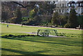
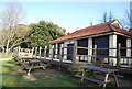
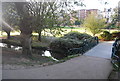
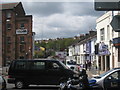
Photos of Braybrooke Ward
Area Information
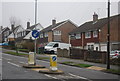
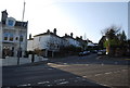
Braybrooke Ward occupies a specific corner of Hastings Borough Council within East Sussex, covering an area of 1.2 km². This historic district council ward has maintained its boundaries through generations, reflecting a stable location near Hastings. The land sits at coordinates 50.863180980920475, 0.5757882029134166, placing it firmly in South East England. Living here means residing in a ward that functions as a child ward of the borough, existing across a long history of local governance. You are looking at a compact district where daily life revolves around the immediate surroundings of this 1.2 km² space. The area operates under a council ward designation that provides a layer of administrative history. Prospective buyers should note the ward name appears as Braybrooke Ward in official records. The physical size is small enough that distances within the ward are short, yet the location connects you to the broader Hastings area. This ward represents a established community unit within the larger borough structure. The boundaries have remained consistent enough to define a recognisable community space for residents. Your location here links you to the traditional governance structures of Hastings Borough Council. The ward identity is rooted in these long-standing administrative definitions rather than temporary zoning.
- Area Type
- District Borough Unitary Ward
- Area Size
- 1.2 km²
- Population
- Not available
- Population Density
- Not available
Demographics
The community character of Braybrooke Ward is most strongly defined by an older age profile, with a median age of 70 years. This figure indicates that two-thirds of the population is older than the midpoint of the age range. The demographic data does not specify the most common age range beyond the total population figure, but the median confirms a mature residential base. Nearly 60 per cent of residents own their homes outright, creating a high proportion of owner-occupied properties within the ward. The remaining 40 per cent live in accommodation arrangements where ownership is different. Household composition data is recorded as a total, suggesting a standard breakdown of family and single-occupancy homes exists. Religion and ethnic group information are recorded as totals in the available statistics, meaning you should not expect highly specific diversity data in these categories from this source. The ward hosts a population where home ownership outweighs renting, mirroring the habits of many historic English wards. Residents here are likely to be established long-term rather than transient commuters. The lack of detailed breakdown in household composition means you will find a typical mix of family units and singles. The median age of 70 suggests a quiet, settled atmosphere where neighbours know each other well. This age demographic influences local spending habits and the demand for specific local amenities.
Household Size
Accommodation Type
Tenure
Ethnic Group
Religion
Household Composition
Age
Household Deprivation
NS-SEC
Explore more demographic insights in this area
Go to Demographics tabPlanning
Planning Constraints
- Flood RiskPremium
- Ramsar Wetland SitesPremium
- Area of Outstanding Natural BeautyPremium
- Protected Nature ReservePremium
- Protected WoodlandPremium