Area Overview for Bradenham
Photos of Bradenham
Area Information
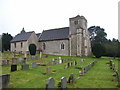
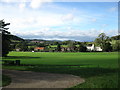
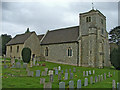
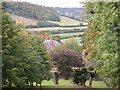
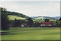
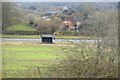
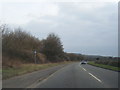
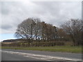
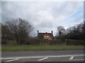
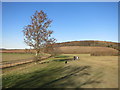
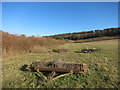
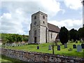
Bradenham is a village and civil parish located in Buckinghamshire, situated within a broad valley among the Chiltern Hills. The area spans 5.2 km² and sits off the A4010 road, placing it between High Wycombe and Princes Risborough near Saunderton. This historic settlement, first recorded in the Domesday Book, retains a distinctly English character defined by brick and flint buildings surrounding a village green that features a cricket pitch. National Trust ownership of much of the village since 1956 has preserved its historic atmosphere, with Bradenham Manor dominating the centre. You will find 17th-century manors, an 18th-century rectory, and the ancient St Botolph's Parish Church overlooking the settlement. Daily life revolves around this small, preserved community where the monthly 'Contact' magazine documents local activities for residents of Bradenham and nearby villages. The location offers quiet residential living close to the Chiltern Hills, yet it remains accessible to the wider transport networks of South East England.
- Area Type
- Parish
- Area Size
- 5.2 km²
- Population
- Not available
- Population Density
- Not available
Demographics
Household Size
Accommodation Type
Tenure
Ethnic Group
Religion
Household Composition
Age
Household Deprivation
NS-SEC
Explore more demographic insights in this area
Go to Demographics tabPlanning
Planning Constraints
- Flood RiskLocked
- Ramsar Wetland SitesLocked
- Area of Outstanding Natural BeautyLocked
- Protected Nature ReserveLocked
- Protected WoodlandLocked
- Crime RiskLocked