Area Overview for BR8 7XW
Photos of BR8 7XW
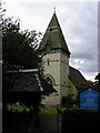
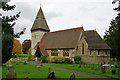
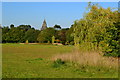
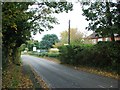
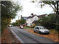
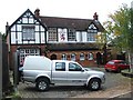
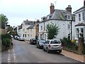
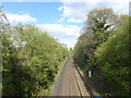
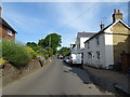
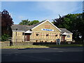
32 photos from this area
Area Information
Key information about the BR8 7XW including its size, population, and administrative classification.
- Area Type
- Postcode
- Area Size
- 12.2 hectares
- Population
- 1553
- Population Density
- 1925 people/km²
House Prices in BR8 7XW
32
Properties
£271,750
Average Sold Price
£99,999
Lowest Price
£570,000
Highest Price
Showing 32 properties
| Address | Type | Beds | Baths | Last Sale Price | Last Sale Date | |
|---|---|---|---|---|---|---|
| 101 Archer Way, Swanley, BR8 7XW | Semi-detached | 3 | 2 | £530,000 | Jul 2025 | |
| 89 Archer Way, Swanley, BR8 7XW | Retail | 3 | 1 | £570,000 | Oct 2022 | |
| 117 Archer Way, Swanley, BR8 7XW | Detached | 3 | 1 | £425,000 | Mar 2019 | |
| 95 Archer Way, Swanley, BR8 7XW | Detached | 4 | 1 | £320,000 | Mar 2014 | |
| 93 Archer Way, Swanley, BR8 7XW | Detached | - | - | £150,000 | Jan 2014 | |
| 91 Archer Way, Swanley, BR8 7XW | Detached | - | - | £150,000 | Dec 2006 | |
| 103 Archer Way, Swanley, BR8 7XW | Semi-detached | - | - | £180,000 | Aug 2002 | |
| 119 Archer Way, Swanley, BR8 7XW | Detached | - | - | £147,500 | Mar 1999 | |
| 113 Archer Way, Swanley, BR8 7XW | Detached | - | - | £145,000 | Dec 1996 | |
| 123 Archer Way, Swanley, BR8 7XW | Detached | - | - | £99,999 | Dec 1995 |
Page 1 of 4
Energy Efficiency in BR8 7XW
Amenities
Schools
| Rank | School | Type | Entry gender | Ages |
|---|
Explore more schools in this area
Go to Schools tabDemographics
Household Size
Family (3-5 people)
most common
Accommodation Type
Houses
most common
Tenure
84
majority
Ethnic Group
White
most common
Religion
N/A
most common
Household Composition
N/A
most common
Age
47
median
Adults (30-64 years)
most common
Household Deprivation
N/A
with no deprivation
NS-SEC
39
in Lower managerial occupations
Explore more demographic insights in this area
Go to Demographics tabPlanning
Planning Constraints
- Flood RiskPremium
- Ramsar Wetland SitesPremium
- Area of Outstanding Natural BeautyPremium
- Protected Nature ReservePremium
- Protected WoodlandPremium