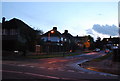
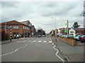
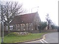
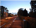
Area Overview for BR8 7UN
Photos of BR8 7UN


Area Information
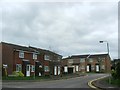
BR8 7UN is a small, densely populated postcode area in Kent, England, covering just 1.2 hectares and home to 1,840 residents. Its compact size means it functions as a tight-knit residential cluster, with a population density of 153,643 people per square kilometre. Located in the Sevenoaks District, this area sits on the outskirts of Greater London, near the M25 motorway, positioning it as a commuter hub. Historically, Swanley—where BR8 7UN lies—developed around its railway junction, becoming a centre for horticulture and healthcare in the 19th century. Today, it retains a practical, working-class character, with a focus on connectivity to London via rail and road. The area’s proximity to Swanley Railway Station and Farningham Road Station makes it accessible for those working in the capital, while local amenities like Asda and Aldi cater to daily needs. Living here means balancing a small, close-knit community with the convenience of urban infrastructure, though the high density may feel cramped for some. The area’s history as a horticultural and medical centre still lingers in its landscape, with remnants of Victorian-era hospitals and orchards subtly influencing its character.
- Area Type
- Postcode
- Area Size
- 1.2 hectares
- Population
- Not available
- Population Density
- Not available
The property market in BR8 7UN is characterised by a 47% home ownership rate, suggesting that nearly half of residents rent their homes. This implies a significant rental market, which may be driven by the area’s role as a commuter town and its proximity to London. The accommodation type is predominantly houses, which is notable given the area’s small size and high density. This mix of larger homes in a compact postcode suggests a blend of older, possibly larger properties and newer developments, though the exact age or condition of these homes is not specified. For buyers, this dynamic means competition for a limited number of properties, particularly houses, which may be in higher demand. The high population density also means that property values could be influenced by proximity to local amenities and transport links. However, the data does not provide specific figures on property prices or trends, so potential buyers should consider the area’s practical appeal—strong rail connections, nearby retail, and a history of infrastructure development—as key factors in their decision-making.
House Prices in BR8 7UN
Showing 1 properties
| Address | Type | Beds | Baths | Last Sale Price | Last Sale Date | |
|---|---|---|---|---|---|---|
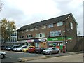
| Pharmacy, Asda Stores, London Road, Swanley, BR8 7UN | shop | - | - | - | - |
Energy Efficiency in BR8 7UN
Residents of BR8 7UN have access to a range of retail and transport amenities within practical reach. The nearby retail sector includes Asda Swanley, Iceland Swanley, and Aldi Swanley, providing essential shopping options for groceries and household items. These stores cater to daily needs, though the data does not specify the variety of other retail outlets or dining options. The rail network, with stations such as Swanley and Farningham Road, offers connectivity to London and surrounding areas, supporting both commuter and leisure travel. While the area’s historical roots in horticulture and healthcare are evident in its landscape, there is no mention of parks or recreational spaces in the immediate vicinity. The presence of multiple retail outlets and rail links suggests a practical, service-oriented lifestyle, with a focus on convenience and accessibility. However, the absence of detailed information on leisure facilities means that potential residents may need to look further afield for cultural or recreational activities.
Amenities
Schools
The area is served by several primary schools, including White Oak Junior School, White Oak Infant School, St Bartholomew’s Catholic Primary School in Swanley (rated ‘good’ by Ofsted), White Oak Primary School, and Horizon Primary School. These institutions cater to a range of educational needs, with multiple options for early years and primary education. The presence of two White Oak schools suggests a local focus on familiar, possibly well-established institutions, while St Bartholomew’s adds a Catholic option with a recognised quality rating. The variety of schools may appeal to families seeking different educational approaches, though the data does not indicate secondary schools or further education facilities in the immediate vicinity. The concentration of primary schools reflects the area’s demographic profile, with a significant proportion of residents in the 30–64 age range likely to have children in these schools. However, parents may need to look beyond BR8 7UN for secondary education options, which could impact long-term planning for families.
| Rank | School | Type | Entry gender | Ages |
|---|
Explore more schools in this area
Go to Schools tabDemographics
The population of BR8 7UN has a median age of 47, with the majority of residents falling within the 30–64 age range. This suggests a community dominated by working-age adults, many of whom are likely employed in nearby industries or commuting to London. Home ownership rates stand at 47%, indicating a mix of owner-occupied and rental properties, though the exact balance between the two is not specified. The predominant accommodation type is houses, which is unusual for a densely populated area, hinting at a blend of older, larger homes and newer developments. The predominant ethnic group is White, with no specific data on other demographics provided. The lack of detailed diversity metrics means the area’s cultural composition remains largely unexplored in the data. With a population density over 150,000 people per square kilometre, residents may experience a high degree of proximity to neighbours, which could influence both community interaction and living conditions. The absence of specific deprivation data means it is unclear how economic factors might affect quality of life, though the area’s role as a commuter hub suggests a workforce reliant on external employment opportunities.
Household Size
Accommodation Type
Tenure
Ethnic Group
Religion
Household Composition
Age
Household Deprivation
NS-SEC
Explore more demographic insights in this area
Go to Demographics tabPlanning
Planning Constraints
- Flood RiskPremium
- Ramsar Wetland SitesPremium
- Area of Outstanding Natural BeautyPremium
- Protected Nature ReservePremium
- Protected WoodlandPremium