Area Overview for BR8 7RN
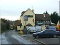
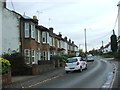
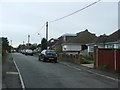
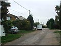
Photos of BR8 7RN
Area Information
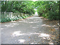
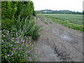
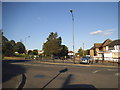
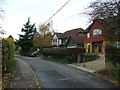
BR8 7RN is a small residential cluster in north west Kent, positioned between Dartford and Swanley, approximately 16 miles from central London. Its semi-rural character persists despite proximity to the M25, with green belt land surrounding the area. The population of 1,426 reflects a tight-knit community, with a median age of 47 and a majority of residents aged 30–64. This suggests a stable, established population, likely drawn from professional or semi-retired individuals. The area’s history as a village with Victorian-era villas and historic covenants—such as bans on public houses—adds to its distinct identity. Daily life here balances rural tranquillity with practical access to nearby towns. The village green, lit with Christmas lights annually, and local amenities like a post office and hardware store create a self-contained environment. While the area is small, its proximity to Swanley and the M25 offers connectivity to larger urban centres without sacrificing the charm of a village setting. For those seeking a quieter lifestyle with easy access to London, BR8 7RN combines practicality with a preserved sense of community.
- Area Type
- Postcode
- Area Size
- Not available
- Population
- Not available
- Population Density
- Not available
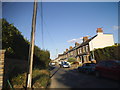
The property market in BR8 7RN is characterised by a high rate of home ownership—87%—indicating a community where most residents live in owner-occupied homes. The predominant accommodation type is houses, which suggests a focus on family-sized properties rather than flats or apartments. This aligns with the area’s semi-rural nature, where larger homes are more common. Given the small population and the fact that the postcode covers a single residential cluster, the housing stock is likely limited in both quantity and variety. Buyers should consider that the market may be niche, with properties reflecting the village’s character, such as older homes with historical features. The high home ownership rate implies limited rental availability, which could be advantageous for those seeking a stable, long-term investment. However, the small size of the area means that buyers may need to look beyond BR8 7RN for more options, particularly if they require specific property types or larger spaces.
House Prices in BR8 7RN
Showing 7 properties
| Address | Type | Beds | Baths | Last Sale Price | Last Sale Date | |
|---|---|---|---|---|---|---|
| 6 Geranium Close, Swanley, BR8 7RN | house | - | - | - | - | |
| 4 Geranium Close, Swanley, BR8 7RN | house | - | - | - | - | |
| 2 Geranium Close, Swanley, BR8 7RN | house | - | - | - | - | |
| 1 Geranium Close, Swanley, BR8 7RN | house | - | - | - | - | |
| 7 Geranium Close, Swanley, BR8 7RN | house | - | - | - | - | |
| 5 Geranium Close, Swanley, BR8 7RN | house | - | - | - | - | |
| 3 Geranium Close, Swanley, BR8 7RN | house | - | - | - | - |
Energy Efficiency in BR8 7RN
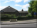
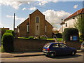
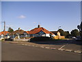
The lifestyle in BR8 7RN is shaped by its semi-rural setting and local amenities. Within practical reach are five retail outlets, including Morrisons Daily, Asda Swanley, and Iceland Swanley, offering everyday shopping needs. The village itself features a tree-lined green, a focal point for community activity, and a recreation ground used for sports like football and cricket. The area’s historical covenants prohibit public houses, reinforcing a quieter, family-oriented atmosphere. Local services such as a post office, hardware store, and chemist provide convenience for daily tasks. The nearby village green and Rec offer leisure opportunities, while the proximity to Swanley and the M25 ensures access to broader urban amenities. The combination of small-town charm and practical connectivity makes BR8 7RN appealing for those seeking a balance between rural living and easy access to towns. The absence of large retail chains or entertainment hubs is compensated by the area’s self-sufficiency and community-focused environment.
Amenities
Schools
Residents of BR8 7RN have access to two schools: Hextable School, a primary school, and Oasis Academy Hextable, an academy. Both institutions serve the local community, providing education from early years through to secondary levels. The presence of a primary school ensures that younger children can attend locally, reducing the need for long commutes. The academy offers a broader curriculum and may cater to a wider age range, though no Ofsted ratings are provided in the data. The mix of school types suggests a range of educational options, though families may need to consider additional travel if they require secondary education beyond the academy’s scope. For those prioritising proximity to schools, BR8 7RN’s offerings are sufficient for primary needs, with the academy potentially serving as a key secondary option. The lack of further schools in the immediate area may necessitate planning for travel to nearby towns for higher education.
| Rank | School | Type | Entry gender | Ages |
|---|
Explore more schools in this area
Go to Schools tabDemographics
The demographic profile of BR8 7RN is defined by a median age of 47, with the majority of residents aged 30–64. This indicates a mature, established population, likely with strong ties to the area. Home ownership is high at 87%, reflecting a community where most residents live in properties they own rather than rent. The predominant accommodation type is houses, suggesting a mix of family homes and larger properties. The predominant ethnic group is White, with no data provided on other ethnicities. The age range and ownership figures imply a stable, low-turnover community. While no specific deprivation data is listed, the high home ownership and low crime risk (85/100) suggest a relatively affluent and secure environment. The absence of significant demographic diversity may appeal to those seeking a homogeneous, family-oriented neighbourhood. The area’s age profile also aligns with a population that may prioritise stability and long-term residency over transient lifestyles.
Household Size
Accommodation Type
Tenure
Ethnic Group
Religion
Household Composition
Age
Household Deprivation
NS-SEC
Explore more demographic insights in this area
Go to Demographics tabPlanning
Planning Constraints
- Flood RiskPremium
- Ramsar Wetland SitesPremium
- Area of Outstanding Natural BeautyPremium
- Protected Nature ReservePremium
- Protected WoodlandPremium