Area Overview for Borough Green & Platt Ward
Photos of Borough Green & Platt Ward

Area Information
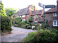
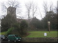
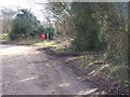
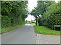
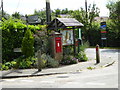
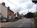
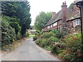
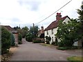
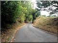
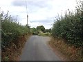
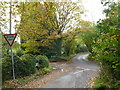
Living in Borough Green & Platt Ward offers a distinct lifestyle defined by its rural character within the wider Dartford Borough unitary authority. This ward covers an area of 9.1 square kilometres, providing a compact yet open space for residents to enjoy. The community here is settled and calm, appealing to those seeking a tranquil environment away from the busiest parts of the county. Daily life revolves around a steady pace, where proximity to heritage and nature remains a central feature. You will find yourself in a locality where the rhythm of life is determined more by local routines than by commuter traffic. The ward sits between the picturesque villages of the North Downs, offering a backdrop of greenery that defines the neighbourhood. While it is part of the Borough Green district, the Platt Ward section retains its own specific identity shaped by the land it encompasses. Anyone considering homes in this area should expect a focus on conservation and quality of life. The sense of place is strong, with the landscape dictating many aspects of life for you. You are situated in an area where the natural surroundings are not just a backdrop but a defining element of the home. The 9.1 square kilometre footprint means that distances are manageable, allowing for easy access to local amenities while preserving the quiet atmosphere you might be seeking. Whether you are looking at schools near Borough Green or exploring local parks in Platt, the environment supports a grounded and peaceful existence. This is a location where the boundary between home and nature is subtle, and the community thrives on this connection.
- Area Type
- District Borough Unitary Ward
- Area Size
- 9.1 km²
- Population
- Not available
- Population Density
- Not available
Demographics
The community of Borough Green & Platt Ward is almost certainly made up of older residents, with a median age of 70 years old for the total population. This age profile suggests a demographic dominated by retirees rather than young families or working-age adults. Consequently, you will find an environment that caters to the needs of seniors, with housing stock and local facilities likely reflecting this reality. The high median age influences social interactions, making the neighbourhood feel more settled and less transient. When you consider who lives here, the data points clearly to a mature population establishing long-term roots in the area. Home ownership stands at a remarkably high level of 77% within the ward. This figure indicates that the vast majority of homes in Borough Green & Platt Ward are owned outright or with a mortgage, rather than being part of the private rental sector. Such a high rate of ownership is typical of established retirement havens where residents purchase and stay for decades. This stability creates a neighbourhood with deep local knowledge and strong community ties. Accommodation types will predominantly match this ownership model, focusing on houses suited to older occupants rather than high-density flats designed for transient renters. For you as a potential buyer, these demographics provide clarity on the target market. The area is not a hub for young professionals or rapidly changing household structures. Instead, it offers a stable environment where neighbours have known each other for generations. The population composition means that schools near Borough Green may see different enrolment patterns compared to areas with younger families. Understanding this age dynamic is essential when planning your move, particularly if you require services or amenities suited to an older demographic.
Household Size
Accommodation Type
Tenure
Ethnic Group
Religion
Household Composition
Age
Household Deprivation
NS-SEC
Explore more demographic insights in this area
Go to Demographics tabPlanning
Planning Constraints
- Flood RiskPremium
- Ramsar Wetland SitesPremium
- Area of Outstanding Natural BeautyPremium
- Protected Nature ReservePremium
- Protected WoodlandPremium
- Crime RiskPremium