Area Overview for Borough Green
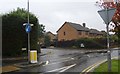
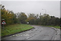
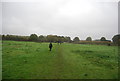
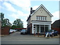
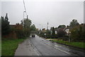
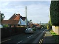
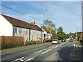
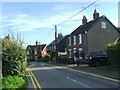
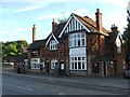
Photos of Borough Green


Area Information
Borough Green is a compact built-up area spanning 2.0 km², situated in England. Its character is defined by a mature population, with a median age of 70, suggesting a community shaped by long-term residents. The area’s home ownership rate of 78% indicates a stable, largely owner-occupied demographic, which often correlates with a sense of permanence and local investment. Living in Borough Green offers proximity to essential services, including five retail outlets like Sainsburys and Waitrose, and accessible rail links to nearby stations such as Borough Green & Wrotham. Daily life here is grounded in practicality, with amenities within walking or short driving distance. The area’s size, while modest, allows for a tight-knit community feel, though its small footprint may limit the diversity of local facilities. For those prioritising convenience over sprawling urban spaces, Borough Green provides a self-contained environment where essential needs are met without the need for long commutes. The presence of a primary school with a good Ofsted rating further reinforces its appeal for families seeking a settled, low-maintenance lifestyle.
- Area Type
- Built Up Area 250
- Area Size
- 2.0 km²
- Population
- Not available
- Population Density
- Not available
Borough Green offers a range of amenities within practical reach, enhancing daily life for residents. The area’s five retail outlets, including Sainsburys Borough Green and Waitrose Little Waitrose, provide access to groceries, household goods, and other essentials. The presence of multiple railway stations, such as Borough Green & Wrotham and West Malling, ensures easy access to regional transport networks, facilitating travel for work, leisure, or shopping. While the data does not mention parks or leisure facilities, the proximity to rail links and retail options suggests a lifestyle focused on convenience and connectivity. The combination of local shops and transport links allows residents to manage daily tasks without venturing far from the area, contributing to a self-sufficient community environment.
Amenities
Schools
The nearest school to Borough Green is Borough Green Primary School, which has an Ofsted rating of ‘good’. This rating suggests that the school provides a satisfactory standard of education, though it does not indicate exceptional performance. As a primary school, it serves the needs of younger families in the area, offering a local option for children aged 4 to 11. The absence of secondary schools or other educational institutions in the data means that students may need to travel further for secondary education. For families prioritising proximity to schools, Borough Green’s primary school is a practical resource, but the limited range of educational facilities may require additional planning for older children.
| Rank | School | Type | Entry gender | Ages |
|---|
Explore more schools in this area
Go to Schools tabDemographics
The population of Borough Green has a median age of 70, reflecting a community skewed towards older residents. This demographic profile suggests a population that is largely retired or in later life, which may influence local social dynamics and service demands. Home ownership is high at 78%, indicating that most residents own their properties rather than rent, which can contribute to a sense of stability. However, the data does not specify household composition or accommodation types, meaning the balance between single-person households, families, or other groupings remains unclear. The predominant ethnic group and religious composition are also not detailed, so it is not possible to assess cultural or social diversity in this area. The absence of specific data on deprivation or socioeconomic factors means that quality of life implications, such as access to healthcare or leisure activities, cannot be fully evaluated.
Household Size
Accommodation Type
Tenure
Ethnic Group
Religion
Household Composition
Age
Household Deprivation
NS-SEC
Explore more demographic insights in this area
Go to Demographics tabPlanning
Planning Constraints
- Crime RiskPremium