Area Overview for Bobbing
Photos of Bobbing
Area Information
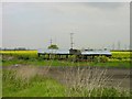
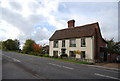
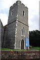
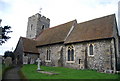
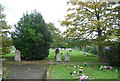
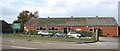
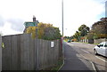
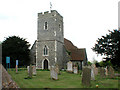
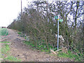
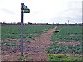
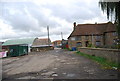
Bobbing is a small civil parish in Kent with a distinct character defined by its rural setting and quiet pace. It covers an area of 6.3 km², creating a compact neighbourhood where daily life moves at a deliberate speed. The population centre is centred around the village itself, offering a sense of community that often appeals to those seeking to escape the noise of larger towns. Life in Bobbing revolves around local amenities and established routines, typical of a traditional English parish rather than a rapidly expanding town. Residents enjoy close proximity to local green spaces and a weathered charm that has remained largely unchanged for decades. You can expect a settled environment where neighbours know one another and the village retains its historic identity. This small footprint means that infrastructure needs less daily wear and tear, preserving the visual appeal of the streets and homes. While it lacks the extensive commercial offerings of cities, the simplicity of the layout makes it easy to navigate on foot or by bicycle. The area suits individuals who value privacy and a straightforward existence over high-octane entertainment or bustling markets. Living in Bobbing offers a retreat from urban chaos while maintaining access to essential services within a short drive.
- Area Type
- Parish
- Area Size
- 6.3 km²
- Population
- Not available
- Population Density
- Not available
Demographics
The community in Bobbing reflects a very specific stage in the life cycle of a rural village. The median age stands at 70, indicating that the majority of residents are seniors. This demographic profile explains the quiet atmosphere and the nature of daily interactions within the parish. A significant portion of the population falls into the older age bracket, creating a stable and settled neighbourhood. Home ownership is exceptionally common here, with 87% of households owning their property outright or with a significant portion of the mortgage cleared. This high level of tenure suggests a community with deep local roots and long-term residence rather than transient gaps. The household composition leans heavily towards families or individuals in later life stages, meaning shared housing or multi-generational setups are likely. Ethnic diversity and religious affiliation represent a general cross-section of the local population without specific standout statistics. Residents here have largely stayed put, building lives around the same institutions and neighbours. The absence of a youthful skew means schools may cater primarily to younger families commuting from elsewhere. You should expect a friendly but mature social circle where decision-making happens slowly and change comes gradually.
Household Size
Accommodation Type
Tenure
Ethnic Group
Religion
Household Composition
Age
Household Deprivation
NS-SEC
Explore more demographic insights in this area
Go to Demographics tabPlanning
Planning Constraints
- Flood RiskPremium
- Ramsar Wetland SitesPremium
- Area of Outstanding Natural BeautyPremium
- Protected Nature ReservePremium
- Protected WoodlandPremium