Area Overview for BN9 0QG
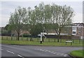
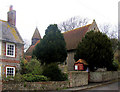
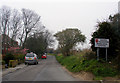
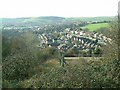
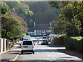
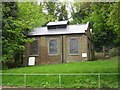
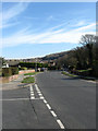
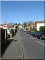
Photos of BN9 0QG

Area Information
BN9 0QG is a specific postcode area covering a small residential cluster within the larger town of Newhaven in East Sussex. This area spans 1863 square metres and is home to a population of 1505. Newhaven itself is a historic port town at the mouth of the River Ouse, known for its maritime heritage and ferry services to France. The settlement originated as the village of Meeching, but the current harbour mouth was established after a significant shift in the river course following a storm in 1570. Residents of BN9 0QG live in a setting defined by this coastal history, situated within the Lewes district. You are moving into an environment where the legacy of the Parker Pen Company and the original lifeboat station established in 1803 shapes the local character. Daily life here offers a distinct blend of suburbia and industrial port history. The small size of the postcode means communities are tight-knit, yet you retain access to the facilities of the wider Newhaven area. Properties here represent a stable investment within a region that balances residential living with significant commercial transport links via its railway and ferry terminals.
- Area Type
- Postcode
- Area Size
- 1863 m²
- Population
- Not available
- Population Density
- Not available
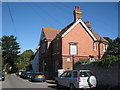
The housing market in BN9 0QG is defined by a high level of stability and permanence. With 85% home ownership, the majority of properties in this postcode are sold privately rather than rented. This contrasts sharply with primary city locations where investment buy-to-let portfolios often dominate. The accommodation type is strictly houses, which means any homes you consider will have traditional structures rather than converted residential units. This lack of flats makes the area particularly suitable for those seeking a house with dedicated outdoor space or a traditional layout. Because the postcode covers only 1863 square metres, supply is limited, and every property represents a chance to secure a foothold in a desirable location. Buyers looking for homes in BN9 0QG should focus on freehold transactions. The high ownership rate implies that the area has low rental turnover. You are not competing with multiple corporate landlords or short-term lets. Instead, you are joining a cohort of permanent residents who intend to stay in Newhaven for the long term.
House Prices in BN9 0QG
Showing 6 properties
| Address | Type | Beds | Baths | Last Sale Price | Last Sale Date | |
|---|---|---|---|---|---|---|
| 128 Denton Road, Newhaven, BN9 0QG | house | - | - | £365,000 | Jan 2025 | |
| 119 Denton Road, Newhaven, BN9 0QG | Terraced | 4 | - | £180,000 | Jun 2022 | |
| 126 Denton Road, Newhaven, BN9 0QG | Retail | 3 | 1 | £370,000 | May 2022 | |
| 121 Denton Road, Newhaven, BN9 0QG | house | - | - | £343,000 | Jul 2018 | |
| Flat 1, 117 Denton Road, Newhaven, BN9 0QG | Flat | - | - | - | - | |
| Denton Stores, 117 Denton Road, Newhaven, BN9 0QG | house | - | - | - | - |
Energy Efficiency in BN9 0QG
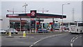
Daily life in BN9 0QG revolves around practical amenities within practical reach. You have access to five retail outlets, including Spar, Sainsburys Newhaven, and Lidl Newhaven, ensuring your grocery shopping and general household needs are met without a long drive. Travel is convenient via the five nearby railway stations, which include Newhaven Town Railway Station, Newhaven Harbour Railway Station, and Bishopstone Railway Station. These hubs provide links to Lewes and enable access to the wider South East network. Living in BN9 0QG means you are close to these essential services while remaining in a quieter residential setting. The local amenities cater to practical daily routines rather than luxury entertainment. Sainsburys Newhaven offers a full range of groceries, while Lidl and Spar provide quicker, more affordable options for everyday items. The nearby rail stations allow you to reach nearby towns easily for leisure or work. This balance of local convenience and regional access defines the character of BN9 0QG, where homebuyers can enjoy port-town access without the noise of the harbour itself.
Amenities
Schools
There is only one educational institution listed immediately adjacent to BN9 0QG. Compass Community School South operates on the boundary of this postcode. This facility is a special school, catering to students with specific educational needs. The absence of mainstream primary or secondary schools within walking distance of this specific cluster means families should plan transport to wider Newhaven for standard education. Special needs provision exists nearby, offering support for children requiring tailored instruction in a residential setting. The diversity of school types in the immediate vicinity is minimal, as BN9 0QG is primarily a residential housing area rather than a school hub. Prospective parents must consider the commute to other schools in the Lewes district for non-specialist education. The location of Compass Community School South provides a dedicated resource for families needing special educational support without travelling far. This limited school presence reflects the area's function as a quiet residential zone rather than a central educational district.
| Rank | School | Type | Entry gender | Ages |
|---|
Explore more schools in this area
Go to Schools tabDemographics
The community in BN9 0QG is predominantly composed of adults aged 30 to 64 years. The median age in this cluster is 47 years, indicating a mature demographic rather than a mix of young families and retirees. Home ownership is very high, with 85% of residents owning their homes free of mortgage. This high ownership rate suggests a stable, long-term population rather than a transient rental market. The accommodation type in this postcode is exclusively houses, meaning you will find no flats or apartments within BN9 0QG. The predominant ethnic group is White, reflecting the general demographic profile of the Newhaven district. With a population density that is unusually high for a residential postcode, the area feels contained and familiar. You are buying into an established neighbourhood where most people have chained themselves to the area through ownership. This demographic profile creates a quiet atmosphere where daily routines are predictable and neighbours know one another.
Household Size
Accommodation Type
Tenure
Ethnic Group
Religion
Household Composition
Age
Household Deprivation
NS-SEC
Explore more demographic insights in this area
Go to Demographics tabPlanning
Planning Constraints
- Flood RiskPremium
- Ramsar Wetland SitesPremium
- Area of Outstanding Natural BeautyPremium
- Protected Nature ReservePremium
- Protected WoodlandPremium