Area Overview for BN8 6PR
Photos of BN8 6PR

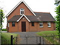
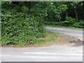
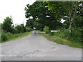
29 photos from this area
Area Information
Key information about the BN8 6PR including its size, population, and administrative classification.
- Area Type
- Postcode
- Area Size
- 1.5 km²
- Population
- 1506
- Population Density
- 91 people/km²
House Prices in BN8 6PR
41
Properties
£872,000
Average Sold Price
£430,000
Lowest Price
£3,165,000
Highest Price
Showing 41 properties
| Address | Type | Beds | Baths | Last Sale Price | Last Sale Date | |
|---|---|---|---|---|---|---|
| Penlan, Knowle Lane, Halland, BN8 6PR | Bungalow | 3 | 2 | £850,000 | Nov 2022 | |
| Timber Tops, Knowle Lane, Halland, BN8 6PR | Detached | 4 | 3 | £600,000 | Jul 2021 | |
| The Nook, Knowle Lane, Halland, BN8 6PR | Detached | - | - | £538,000 | Jan 2021 | |
| Glowbaun, Knowle Lane, Halland, BN8 6PR | Detached | 4 | 2 | £590,000 | Nov 2020 | |
| Knoll Cottage, Knowle Lane, Halland, BN8 6PR | Detached | 4 | 1 | £800,000 | Jul 2020 | |
| Bentley Wood, Knowle Lane, Halland, BN8 6PR | Detached | 7 | 4 | £3,165,000 | Mar 2020 | |
| The Locks, Knowle Lane, Halland, BN8 6PR | Detached | 4 | 3 | £750,000 | Feb 2017 | |
| Amberley, Knowle Lane, Halland, BN8 6PR | Detached | 3 | 2 | £455,000 | Feb 2014 | |
| Vine Farm Cottage, Knowle Lane, Halland, BN8 6PR | Detached | 4 | 2 | £542,000 | Jan 2010 | |
| Cherry Tree House, Knowle Lane, Halland, BN8 6PR | house | - | - | £430,000 | Sep 2004 |
Page 1 of 5
Energy Efficiency in BN8 6PR
Amenities
Schools
| Rank | School | Type | Entry gender | Ages |
|---|
Explore more schools in this area
Go to Schools tabDemographics
Household Size
Two person
most common
Accommodation Type
Houses
most common
Tenure
76
majority
Ethnic Group
White
most common
Religion
N/A
most common
Household Composition
N/A
most common
Age
47
median
Adults (30-64 years)
most common
Household Deprivation
N/A
with no deprivation
NS-SEC
38
in Lower managerial occupations
Explore more demographic insights in this area
Go to Demographics tabPlanning
Planning Constraints
- Flood RiskPremium
- Ramsar Wetland SitesPremium
- Area of Outstanding Natural BeautyPremium
- Protected Nature ReservePremium
- Protected WoodlandPremium