Area Overview for BN8 6NZ
Photos of BN8 6NZ
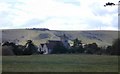

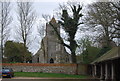
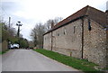
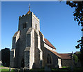
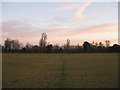
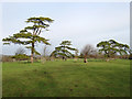
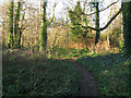
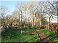
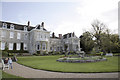
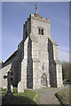
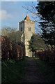
100 photos from this area
Area Information
Key information about the BN8 6NZ including its size, population, and administrative classification.
- Area Type
- Postcode
- Area Size
- 58.3 hectares
- Population
- 1552
- Population Density
- 41 people/km²
House Prices in BN8 6NZ
9
Properties
£719,500
Average Sold Price
£659,000
Lowest Price
£780,000
Highest Price
Showing 9 properties
| Address | Type | Beds | Baths | Last Sale Price | Last Sale Date | |
|---|---|---|---|---|---|---|
| 80 Heighton Street, Firle, BN8 6NZ | house | - | - | £780,000 | Sep 2025 | |
| 79 Heighton Street, Firle, BN8 6NZ | house | - | - | £659,000 | Oct 2015 | |
| The Old Dairy, Heighton Street, Firle, BN8 6NZ | hotel | - | - | - | - | |
| Yampcamp Limited, Heighton Street, Firle, BN8 6NZ | commercial | - | - | - | - | |
| 81 Heighton Street, Firle, BN8 6NZ | Detached | - | - | - | - | |
| 75 Heighton Street, Firle, BN8 6NZ | house | - | - | - | - | |
| 76 Heighton Street, Firle, BN8 6NZ | house | - | - | - | - | |
| 77 Heighton Street, Firle, BN8 6NZ | house | - | - | - | - | |
| Newhaven Archery Club, Heighton Street, Firle, BN8 6NZ | Leisure | - | - | - | - |
Energy Efficiency in BN8 6NZ
Amenities
Schools
| Rank | School | Type | Entry gender | Ages |
|---|
Explore more schools in this area
Go to Schools tabDemographics
Household Size
Two person
most common
Accommodation Type
Houses
most common
Tenure
37
majority
Ethnic Group
White
most common
Religion
N/A
most common
Household Composition
N/A
most common
Age
47
median
Adults (30-64 years)
most common
Household Deprivation
N/A
with no deprivation
NS-SEC
27
in Lower managerial occupations
Explore more demographic insights in this area
Go to Demographics tabPlanning
Planning Constraints
- Flood RiskPremium
- Ramsar Wetland SitesPremium
- Area of Outstanding Natural BeautyPremium
- Protected Nature ReservePremium
- Protected WoodlandPremium