Area Overview for BN8 4SS
Photos of BN8 4SS
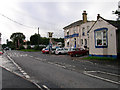
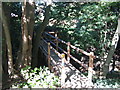
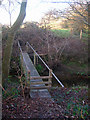
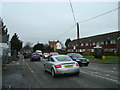
58 photos from this area
Area Information
Key information about the BN8 4SS including its size, population, and administrative classification.
- Area Type
- Postcode
- Area Size
- 35.8 hectares
- Population
- 2230
- Population Density
- 76 people/km²
House Prices in BN8 4SS
10
Properties
£213,750
Average Sold Price
£195,000
Lowest Price
£232,500
Highest Price
Showing 10 properties
| Address | Type | Beds | Baths | Last Sale Price | Last Sale Date | |
|---|---|---|---|---|---|---|
| Woodbine Cottage, Deadmantree Hill, Barcombe, BN8 4SS | Detached | 5 | 3 | £232,500 | Apr 1998 | |
| The Old Post Office, Deadmantree Hill, Barcombe, BN8 4SS | Detached | 5 | 2 | £195,000 | Jan 1995 | |
| Flat, The Rainbow Inn, Deadmantree Hill, Barcombe, BN8 4SS | Flat | - | - | - | - | |
| Manor House, Deadmantree Hill, Barcombe, BN8 4SS | house | 5 | - | - | - | |
| The Yews, Deadmantree Hill, Barcombe, BN8 4SS | house | 3 | - | - | - | |
| Forge Cottage, Deadmantree Hill, Barcombe, BN8 4SS | Semi-detached | - | - | - | - | |
| Yew Tree Cottage, Deadmantree Hill, Barcombe, BN8 4SS | house | - | - | - | - | |
| Wheelwrights, Deadmantree Hill, Barcombe, BN8 4SS | house | - | - | - | - | |
| Recycling Centre, The Rainbow Inn, Deadmantree Hill, Barcombe, BN8 4SS | commercial | - | - | - | - | |
| The Rainbow Inn, Deadmantree Hill, Barcombe, BN8 4SS | restaurant_cafe | - | - | - | - |
Energy Efficiency in BN8 4SS
Amenities
Schools
| Rank | School | Type | Entry gender | Ages |
|---|
Explore more schools in this area
Go to Schools tabDemographics
Household Size
Family (3-5 people)
most common
Accommodation Type
Houses
most common
Tenure
69
majority
Ethnic Group
White
most common
Religion
N/A
most common
Household Composition
N/A
most common
Age
47
median
Adults (30-64 years)
most common
Household Deprivation
N/A
with no deprivation
NS-SEC
44
in Lower managerial occupations
Explore more demographic insights in this area
Go to Demographics tabPlanning
Planning Constraints
- Flood RiskPremium
- Ramsar Wetland SitesPremium
- Area of Outstanding Natural BeautyPremium
- Protected Nature ReservePremium
- Protected WoodlandPremium