Area Overview for BN7 2XR
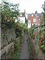
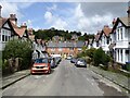
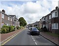
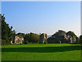
Photos of BN7 2XR
Area Information
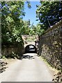
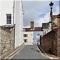
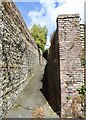
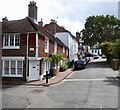
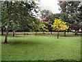
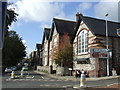
Living in BN7 2XR, a small residential cluster in East Sussex, means being part of a tight-knit community with a rich historical and cultural backdrop. The area sits within Lewes, the county town of East Sussex, a place steeped in medieval heritage and active local traditions. With a population of 1,330 and a density of 1,025 people per square kilometre, this postcode reflects a compact, residential character. Daily life is shaped by the town’s role as a historic market hub, with its narrow streets lined with timber-framed buildings and Georgian architecture. Residents benefit from proximity to the River Ouse and the South Downs, offering both scenic vistas and recreational opportunities. The area’s charm lies in its balance of historical significance and modern practicality, with amenities like retail outlets and rail links within easy reach. For those seeking a blend of heritage and convenience, BN7 2XR offers a distinct identity, where the past and present coexist in a well-defined, manageable space.
- Area Type
- Postcode
- Area Size
- Not available
- Population
- 1330
- Population Density
- 1025 people/km²
BN7 2XR is a predominantly owner-occupied area, with 72% of homes owned by their occupants. This suggests a stable property market where long-term residency is common, and rental demand may be lower compared to urban areas. The accommodation type is primarily houses, which is typical of smaller towns and rural clusters. This housing stock likely includes a mix of older properties with historical features, such as timber-framed or Georgian-style homes, given Lewes’s architectural heritage. For buyers, this means a focus on individual homes rather than apartments or flats, with potential for character properties. However, the small size of the area and its residential nature may limit availability, making it a niche market for those seeking a quiet, historically rich environment. The lack of data on property prices or recent developments means buyers should consider local real estate agents for up-to-date insights.
House Prices in BN7 2XR
Showing 2 properties
| Address | Type | Beds | Baths | Last Sale Price | Last Sale Date | |
|---|---|---|---|---|---|---|
| Benefits Agency, Medwyn House, Mountfield Road, Lewes, BN7 2XR | office_workshop | - | - | - | - | |
| Recycling Centre, Medwyn House, Mountfield Road, Lewes, BN7 2XR | commercial | - | - | - | - |
Energy Efficiency in BN7 2XR
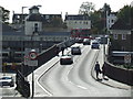
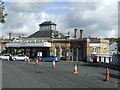
Life in BN7 2XR is shaped by its proximity to Lewes’s historic core and practical amenities. Nearby shops such as Budgens Station, Morrisons Daily, and Cook Lewes provide everyday essentials, while rail stations offer easy access to wider networks. The area’s character is defined by its medieval lanes and historic architecture, with landmarks like Lewes Castle and Harvey & Son’s Brewery adding cultural depth. Residents can enjoy the River Ouse and South Downs for leisure, though specific parks or recreational spaces are not detailed in the data. The presence of multiple schools and a sixth-form college supports family life, while the town’s role as a market hub ensures a steady flow of activity. The balance of heritage and convenience makes BN7 2XR appealing to those valuing a settled, community-focused lifestyle.
Amenities
Schools
Residents of BN7 2XR have access to a range of educational institutions, including primary schools and a sixth-form college. Western Road Community Primary School, Southover CofE Primary School, and Priory School all hold Ofsted ratings of “good,” indicating reliable standards for early education. Lewes Tutorial Unit, while categorised as “other,” may offer specialist or alternative learning options. For secondary education, Sussex Downs College provides sixth-form provision, catering to older students. The mix of school types ensures families can choose between state-funded primary education and further study opportunities. The presence of multiple schools with positive Ofsted ratings suggests a strong educational infrastructure, though the absence of data on school catchment areas or performance metrics means prospective families should verify admissions policies locally.
| Rank | School | Type | Entry gender | Ages |
|---|
Explore more schools in this area
Go to Schools tabDemographics
BN7 2XR is predominantly home to adults aged 30–64, with a median age of 47. This suggests a mature, settled community, likely with established careers and families. Home ownership is high at 72%, indicating a stable housing market where most residents live in their own homes rather than renting. The accommodation type is primarily houses, reflecting a suburban or semi-rural layout typical of smaller towns. The predominant ethnic group is White, aligning with broader demographic trends in the region. While the data does not specify deprivation levels, the high home ownership and age profile suggest a community with relatively stable economic conditions. The absence of specific diversity metrics means the area’s social composition is not detailed beyond the predominant group. For buyers, this implies a neighbourhood with long-term residents and a focus on family-oriented living, though broader cultural diversity is not explicitly noted.
Household Size
Accommodation Type
Tenure
Ethnic Group
Religion
Household Composition
Age
Household Deprivation
NS-SEC
Explore more demographic insights in this area
Go to Demographics tabPlanning
Planning Constraints
- Flood RiskPremium
- Ramsar Wetland SitesPremium
- Area of Outstanding Natural BeautyPremium
- Protected Nature ReservePremium
- Protected WoodlandPremium