Area Overview for BN7 2BS
Photos of BN7 2BS
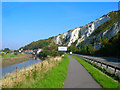
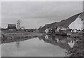
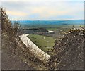
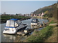
100 photos from this area
Area Information
Key information about the BN7 2BS including its size, population, and administrative classification.
- Area Type
- Postcode
- Area Size
- 23.8 hectares
- Population
- 1770
- Population Density
- 569 people/km²
House Prices in BN7 2BS
43
Properties
£501,832
Average Sold Price
£79,000
Lowest Price
£1,476,000
Highest Price
Showing 43 properties
| Address | Type | Beds | Baths | Last Sale Price | Last Sale Date | |
|---|---|---|---|---|---|---|
| 70 South Street, Lewes, BN7 2BS | house | 3 | 2 | £580,000 | Sep 2024 | |
| 56 South Street, Lewes, BN7 2BS | Terraced | 2 | 1 | £414,000 | May 2024 | |
| 122 South Street, Lewes, BN7 2BS | house | 2 | 1 | £475,000 | Nov 2022 | |
| 36 South Street, Lewes, BN7 2BS | Retail | 3 | 1 | £640,000 | Aug 2022 | |
| 78 South Street, Lewes, BN7 2BS | Terraced | 2 | 1 | £508,000 | Jul 2022 | |
| 42 South Street, Lewes, BN7 2BS | house | - | - | £496,000 | Nov 2021 | |
| 72 South Street, Lewes, BN7 2BS | house | - | - | £600,000 | Jun 2021 | |
| 68 South Street, Lewes, BN7 2BS | house | - | - | £420,000 | May 2021 | |
| 82 South Street, Lewes, BN7 2BS | house | - | - | £887,500 | Mar 2021 | |
| 38 South Street, Lewes, BN7 2BS | Terraced | 2 | - | £485,000 | Dec 2019 |
Page 1 of 5
Energy Efficiency in BN7 2BS
Amenities
Schools
| Rank | School | Type | Entry gender | Ages |
|---|
Explore more schools in this area
Go to Schools tabDemographics
Household Size
One person
most common
Accommodation Type
Houses
most common
Tenure
55
majority
Ethnic Group
White
most common
Religion
N/A
most common
Household Composition
N/A
most common
Age
47
median
Adults (30-64 years)
most common
Household Deprivation
N/A
with no deprivation
NS-SEC
48
in Lower managerial occupations
Explore more demographic insights in this area
Go to Demographics tabPlanning
Planning Constraints
- Flood RiskPremium
- Ramsar Wetland SitesPremium
- Area of Outstanding Natural BeautyPremium
- Protected Nature ReservePremium
- Protected WoodlandPremium