Area Overview for BN7 1PE
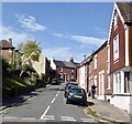
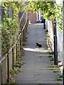
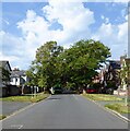
Photos of BN7 1PE
Area Information
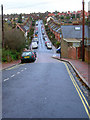
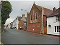
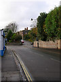
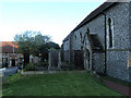
BN7 1PE is a compact residential postcode nestled in the heart of Lewes, East Sussex. Covering just 4,647 square metres, it is a densely populated area with 1,520 residents, translating to a population density of 327,117 people per square kilometre. This small cluster of homes sits within a town steeped in history, where medieval lanes and timber-framed buildings coexist with modern infrastructure. Lewes, as the county town of East Sussex, offers a blend of historic charm and practical amenities. The area’s proximity to the River Ouse and the South Downs provides a scenic backdrop, while its role as a communications hub ensures connectivity. Daily life here is shaped by a tight-knit community, with residents benefiting from nearby schools, rail links, and a rich cultural heritage. The town’s historical significance, including its association with the 16th-century Protestant martyrs and its annual Guy Fawkes Day celebrations, adds a unique character to living in BN7 1PE.
- Area Type
- Postcode
- Area Size
- 4647 m²
- Population
- 1520
- Population Density
- 4047 people/km²
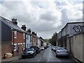
BN7 1PE is a largely owner-occupied area, with 67% of properties owned by residents rather than rented. The accommodation type is predominantly houses, which aligns with the area’s character as a small, residential cluster. This suggests a housing stock that is likely to be older, with traditional layouts and potentially limited availability of newer developments. Given the postcode’s small size, the property market is likely to be tightly focused on the immediate surroundings, with limited scope for expansion. For buyers, this means competition may be fierce, particularly for homes with specific features or proximity to key amenities like schools and transport links. The high home ownership rate also implies a stable market, where properties are less likely to be vacant or subject to frequent turnover.
House Prices in BN7 1PE
Showing 2 properties
| Address | Type | Beds | Baths | Last Sale Price | Last Sale Date | |
|---|---|---|---|---|---|---|
| Recycling Centre, Victoria Hospital, Nevill Road, Lewes, BN7 1PE | commercial | - | - | - | - | |
| Orchard House, Victoria Hospital, Nevill Road, Lewes, BN7 1PE | hospital_care_home | - | - | - | - |
Energy Efficiency in BN7 1PE
Living in BN7 1PE offers access to a range of amenities within practical reach. Nearby retail options include Morrisons Daily, Budgens Station, and Waitrose Lewes, providing everyday shopping needs. The area’s proximity to Lewes, a historic market town, adds to its appeal, with its medieval architecture, local festivals, and cultural landmarks. Residents can enjoy the town’s character, including timber-framed buildings and the annual Guy Fawkes Day celebrations. The nearby rail stations also open up opportunities for leisure and travel. For daily life, the combination of local shops, historic sites, and transport links creates a convenient yet distinctively traditional environment.
Amenities
Schools
Residents of BN7 1PE have access to two notable schools within practical reach. St Pancras Catholic Primary School is a state-funded primary school, providing education for younger children in a faith-based setting. Nearby, Stream Edge School is an independent institution, offering an alternative to state education with potentially smaller class sizes and specialized curricula. The mix of school types allows families flexibility in choosing between public and private education. Both schools are likely to be well-regarded, given the area’s emphasis on community and historical significance. For parents, the presence of both options ensures a range of educational choices, though specific Ofsted ratings are not provided in the data.
| Rank | School | Type | Entry gender | Ages |
|---|
Explore more schools in this area
Go to Schools tabDemographics
The population of BN7 1PE is predominantly adults aged 30–64, with a median age of 47. This suggests a mature, stable community where many residents are likely to be established professionals or families. Home ownership is high, at 67%, indicating a strong preference for long-term residency. The accommodation type is primarily houses, reflecting a residential profile that leans towards family homes rather than flats. The predominant ethnic group is White, though specific data on diversity is not provided. The high population density, while not uncommon for urban areas, may influence the sense of community and access to shared resources. For quality of life, the age profile suggests a balance between active professionals and retirees, potentially supporting a range of local services and amenities.
Household Size
Accommodation Type
Tenure
Ethnic Group
Religion
Household Composition
Age
Household Deprivation
NS-SEC
Explore more demographic insights in this area
Go to Demographics tabPlanning
Planning Constraints
- Flood RiskPremium
- Ramsar Wetland SitesPremium
- Area of Outstanding Natural BeautyPremium
- Protected Nature ReservePremium
- Protected WoodlandPremium