Area Overview for BN7 1ND
Photos of BN7 1ND
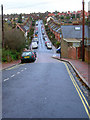
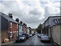
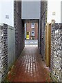
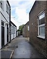
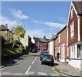
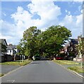
100 photos from this area
Area Information
Key information about the BN7 1ND including its size, population, and administrative classification.
- Area Type
- Postcode
- Area Size
- 6139 m²
- Population
- 1520
- Population Density
- 4047 people/km²
House Prices in BN7 1ND
8
Properties
£324,129
Average Sold Price
£93,500
Lowest Price
£660,000
Highest Price
Showing 8 properties
| Address | Type | Beds | Baths | Last Sale Price | Last Sale Date | |
|---|---|---|---|---|---|---|
| 9 Nevill Crescent, Lewes, BN7 1ND | Semi-detached | 3 | 1 | £660,000 | Aug 2025 | |
| 14 Nevill Crescent, Lewes, BN7 1ND | house | - | - | £414,500 | Aug 2023 | |
| 15A Nevill Crescent, Lewes, BN7 1ND | Maisonette | - | - | £302,000 | May 2016 | |
| 10 Nevill Crescent, Lewes, BN7 1ND | Maisonette | 3 | 1 | £279,950 | Dec 2009 | |
| 12 Nevill Crescent, Lewes, BN7 1ND | Semi-detached | - | - | £274,950 | Aug 2004 | |
| 13 Nevill Crescent, Lewes, BN7 1ND | Terraced | 3 | 1 | £244,000 | Mar 2004 | |
| 15 Nevill Crescent, Lewes, BN7 1ND | Flat | 2 | 1 | £93,500 | Sep 2003 | |
| 11 Nevill Crescent, Lewes, BN7 1ND | Semi-detached | - | - | - | - |
Energy Efficiency in BN7 1ND
Amenities
Schools
| Rank | School | Type | Entry gender | Ages |
|---|
Explore more schools in this area
Go to Schools tabDemographics
Household Size
Family (3-5 people)
most common
Accommodation Type
Houses
most common
Tenure
67
majority
Ethnic Group
White
most common
Religion
N/A
most common
Household Composition
N/A
most common
Age
47
median
Adults (30-64 years)
most common
Household Deprivation
N/A
with no deprivation
NS-SEC
44
in Lower managerial occupations
Explore more demographic insights in this area
Go to Demographics tabPlanning
Planning Constraints
- Flood RiskPremium
- Ramsar Wetland SitesPremium
- Area of Outstanding Natural BeautyPremium
- Protected Nature ReservePremium
- Protected WoodlandPremium