Area Overview for BN6 8UZ
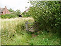
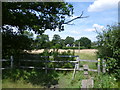
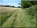
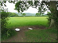
Photos of BN6 8UZ
Area Information
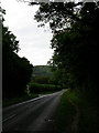
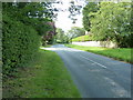
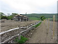
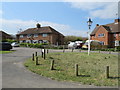
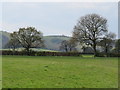
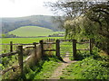
BN6 8UZ is a small residential postcode in the village of Ditchling, East Sussex, nestled within the South Downs National Park. Covering 2.7 hectares, this area is home to 2,554 residents, with a population density of 107 people per square kilometre. The village retains a historic character, marked by its Roman Greensand Way crossing and over 40 listed buildings. Ditchling’s charm lies in its rural setting, blending ancient traditions with modern convenience. The biennial Ditchling Fair, granted in 1312, and the legacy of the Arts and Crafts movement add to its cultural fabric. Residents benefit from proximity to natural landscapes, with the village sitting on a hilltop watershed between the Adur and Ouse catchments. While small, the area offers a mix of historic architecture, including St Margaret’s Church and Wings Place, alongside a thriving artistic community. Living here means embracing a quieter, slower pace of life, with easy access to nearby towns like Burgess Hill and Hassocks for more amenities. The postcode’s compact size ensures a tight-knit community, where local landmarks and traditions remain central to daily life.
- Area Type
- Postcode
- Area Size
- 2.7 hectares
- Population
- 2554
- Population Density
- 107 people/km²
BN6 8UZ is predominantly an owner-occupied area, with 83% of homes owned by residents rather than rented. The accommodation type is primarily houses, which is typical of rural villages where larger properties are more common. Given the small area size of 2.7 hectares and a population of 2,554, the housing stock is limited, meaning properties here are likely to be in high demand. This creates a competitive market for buyers, particularly those seeking a quiet, historic home with low population density. The focus on houses rather than flats or apartments suggests a preference for private, spacious living. For buyers, this area offers a chance to own a property in a well-preserved village with strong local character, though the small size means proximity to nearby towns like Hassocks or Burgess Hill may be necessary for additional amenities.
House Prices in BN6 8UZ
Showing 8 properties
| Address | Type | Beds | Baths | Last Sale Price | Last Sale Date | |
|---|---|---|---|---|---|---|
| Underfield, Beacon Road, Ditchling, BN6 8UZ | Bungalow | 4 | - | £1,050,000 | Feb 2021 | |
| 42A Beacon Road, Ditchling, BN6 8UZ | Detached | 5 | 3 | £1,135,000 | Sep 2015 | |
| 38A Beacon Road, Ditchling, BN6 8UZ | Semi-detached | 3 | - | £1,000,000 | Nov 2013 | |
| 40 Beacon Road, Ditchling, BN6 8UZ | Detached | - | - | £920,000 | May 2013 | |
| Nyemere, 42 Beacon Road, Ditchling, BN6 8UZ | Detached | - | - | £960,000 | Sep 2009 | |
| 38 Beacon Road, Ditchling, BN6 8UZ | Detached | - | - | £895,000 | Nov 2002 | |
| 46 Beacon Road, Ditchling, BN6 8UZ | Detached | - | - | £630,000 | Jan 2000 | |
| Little Nyes, 44 Beacon Road, Ditchling, BN6 8UZ | Detached | - | - | - | - |
Energy Efficiency in BN6 8UZ
BN6 8UZ offers a lifestyle rooted in rural charm, with access to essential amenities within practical reach. Retail options include Morrisons Daily Hassocks 44, Sainsburys Hassocks, and M&S Pyecombe BP, providing grocery and general shopping needs. The village’s historic character is complemented by its proximity to the South Downs National Park, offering walking, cycling, and outdoor recreation opportunities. The Ditchling Fair, held biennially, adds to the community’s cultural calendar. For dining, the area’s small size means reliance on nearby towns, but the village’s listed buildings and artistic legacy contribute to a unique aesthetic. Residents benefit from a mix of historic sites, such as St Margaret’s Church and the Ditchling Museum of Art + Craft, alongside practical rail links. This blend of heritage and convenience creates a lifestyle that values both tradition and accessibility.
Amenities
Schools
Residents of BN6 8UZ have access to two primary schools: Ditchling (St Margaret’s) Church of England Primary School and Ditchling St Margaret’s Church of England Primary School. Both are primary institutions, serving children aged 4–11. The presence of two primary schools in the area provides redundancy and potentially smaller class sizes, though no secondary schools are listed nearby. Families with older children may need to consider commuting to nearby towns for secondary education. The schools’ church-affiliated status may align with local religious or cultural values. While specific Ofsted ratings are not provided, the availability of two primary schools suggests a focus on early education within the village. This supports a family-friendly environment, though parents should verify current school performance and capacity.
| Rank | School | Type | Entry gender | Ages |
|---|
Explore more schools in this area
Go to Schools tabDemographics
The population of BN6 8UZ has a median age of 47, with the elderly (65+ years) forming the most common age group. This suggests a community leaning towards older residents, which may influence local services and social dynamics. Home ownership is high at 83%, indicating a stable, long-term resident base. The predominant accommodation type is houses, reflecting a residential area with single-family homes rather than apartments or flats. The predominant ethnic group is White, which aligns with broader demographic trends in rural East Sussex. With a population density of 107 people per square kilometre, the area remains low-density, offering space and privacy. This profile suggests a community focused on stability and heritage, with limited pressure on housing or infrastructure. The age demographic may mean fewer schools for younger children, but the presence of two primary schools nearby addresses this to some extent.
Household Size
Accommodation Type
Tenure
Ethnic Group
Religion
Household Composition
Age
Household Deprivation
NS-SEC
Explore more demographic insights in this area
Go to Demographics tabPlanning
Planning Constraints
- Flood RiskPremium
- Ramsar Wetland SitesPremium
- Area of Outstanding Natural BeautyPremium
- Protected Nature ReservePremium
- Protected WoodlandPremium