Area Overview for BN5 9WG
Photos of BN5 9WG
Area Information
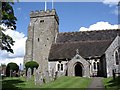
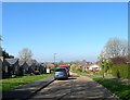
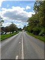
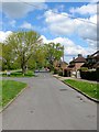
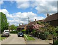
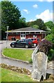
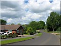
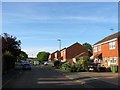
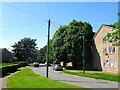
BN5 9WG is a small, tightly knit residential postcode area in West Sussex, nestled within the historic market town of Henfield. With a population of 1530 and a density of 434 people per square kilometre, this area blends rural charm with accessible amenities. Henfield itself is a civil parish with origins dating back to the 8th century, centred around St Peter’s Church, a medieval relic still standing today. The town’s character is defined by its conservation area, which preserves 19th-century cottages and listed buildings, alongside a friendly, intimate atmosphere. Daily life here is shaped by its compact size—residents can walk to shops, the railway station, or the village museum within minutes. The area’s proximity to the River Adur and South Downs offers natural beauty, while the presence of independent businesses and community-focused spaces fosters a strong local identity. For those seeking a peaceful yet connected lifestyle, BN5 9WG balances historical depth with modern convenience, making it an appealing choice for those who value both heritage and practicality.
- Area Type
- Postcode
- Area Size
- Not available
- Population
- 1530
- Population Density
- 434 people/km²
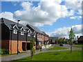
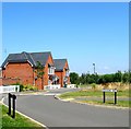
The property market in BN5 9WG is dominated by owner-occupied homes, with 81% of properties owned by residents rather than rented. This high home ownership rate suggests a stable market with long-term residents, which can reduce turnover and competition for buyers. The area’s accommodation is primarily houses, reflecting its rural and semi-rural character, as opposed to apartment blocks or larger residential complexes. This type of housing may appeal to those seeking more space, privacy, or garden access. However, as a small postcode area, the available housing stock is limited, meaning buyers may need to consider nearby suburbs or towns for broader options. The focus on owner-occupation also implies that rental properties are less common, which could affect affordability for those without a mortgage. For buyers, this market offers a chance to invest in a stable, historic community, though the limited supply may require flexibility in location or property type.
House Prices in BN5 9WG
No properties found in this postcode.
Energy Efficiency in BN5 9WG
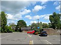
Living in BN5 9WG offers a mix of practicality and charm, with nearby amenities that cater to daily needs. Within walking distance are five retail outlets, including Sainsburys Henfield, Co-op Partridge, and Budgens Upper, providing access to groceries, essentials, and local services. The area’s compact size means residents can easily reach Henfield’s centre, where independent shops, restaurants, pubs, and the Henfield Museum add to the town’s character. The conservation area, which includes historic buildings and 19th-century cottages, contributes to a sense of heritage and community pride. While the area lacks large-scale leisure facilities, its rural setting offers proximity to the River Adur and South Downs, ideal for walking, cycling, or outdoor activities. The combination of local shops, cultural assets, and natural surroundings creates a lifestyle that balances convenience with a slower, more connected pace of life.
Amenities
Schools
| Rank | School | Type | Entry gender | Ages |
|---|
Explore more schools in this area
Go to Schools tabDemographics
The population of BN5 9WG is predominantly elderly, with 65+ years being the most common age range, and the median age sitting at 47. This reflects a community with a significant proportion of older residents, which may influence local services and social dynamics. Home ownership is high at 81%, indicating a stable, long-term resident base. The area is characterised by houses rather than flats, which aligns with its rural and semi-rural nature. The predominant ethnic group is White, though specific diversity data is not detailed in the provided information. The population density of 434 people per square kilometre suggests a close-knit community, where social connections are likely strong. This demographic profile may appeal to buyers seeking a quieter, mature neighbourhood with established infrastructure, though it also means the housing market is less likely to cater to younger families or transient populations.
Household Size
Accommodation Type
Tenure
Ethnic Group
Religion
Household Composition
Age
Household Deprivation
NS-SEC
Explore more demographic insights in this area
Go to Demographics tabPlanning
Planning Constraints
- Flood RiskPremium
- Ramsar Wetland SitesPremium
- Area of Outstanding Natural BeautyPremium
- Protected Nature ReservePremium
- Protected WoodlandPremium