Area Overview for BN5 9SU
Photos of BN5 9SU
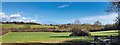
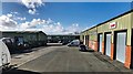
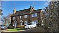
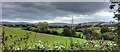
36 photos from this area
Area Information
Key information about the BN5 9SU including its size, population, and administrative classification.
- Area Type
- Postcode
- Area Size
- 43.4 hectares
- Population
- 1343
- Population Density
- 110 people/km²
House Prices in BN5 9SU
8
Properties
£1,240,000
Average Sold Price
£200,000
Lowest Price
£3,300,000
Highest Price
Showing 8 properties
| Address | Type | Beds | Baths | Last Sale Price | Last Sale Date | |
|---|---|---|---|---|---|---|
| Henfield Lodge, Brighton Road, Henfield, BN5 9SU | house | - | - | £3,300,000 | Feb 2021 | |
| Barn Cottage, Brighton Road, Henfield, BN5 9SU | Bungalow | 3 | 1 | £810,000 | Jul 2018 | |
| Kentons Farmhouse, Brighton Road, Henfield, BN5 9SU | Detached | - | - | £650,000 | Jan 2001 | |
| Hole Barn Farm, Brighton Road, Henfield, BN5 9SU | Detached | - | - | £200,000 | Aug 1995 | |
| Hole Farmhouse, Brighton Road, Henfield, BN5 9SU | Detached | - | - | - | - | |
| South Kentwyns, Brighton Road, Henfield, BN5 9SU | Terraced | - | - | - | - | |
| Kentwyn Cottage, Brighton Road, Henfield, BN5 9SU | Detached | - | - | - | - | |
| The Gatehouse, Henfield Lodge, Brighton Road, Henfield, BN5 9SU | Detached | - | - | - | - |
Energy Efficiency in BN5 9SU
Amenities
Schools
| Rank | School | Type | Entry gender | Ages |
|---|
Explore more schools in this area
Go to Schools tabDemographics
Household Size
Two person
most common
Accommodation Type
Houses
most common
Tenure
82
majority
Ethnic Group
White
most common
Religion
N/A
most common
Household Composition
N/A
most common
Age
47
median
Adults (30-64 years)
most common
Household Deprivation
N/A
with no deprivation
NS-SEC
44
in Lower managerial occupations
Explore more demographic insights in this area
Go to Demographics tabPlanning
Planning Constraints
- Flood RiskPremium
- Ramsar Wetland SitesPremium
- Area of Outstanding Natural BeautyPremium
- Protected Nature ReservePremium
- Protected WoodlandPremium