Area Overview for BN5 9RS
Photos of BN5 9RS

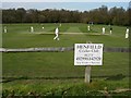
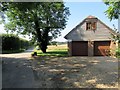
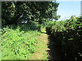
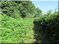
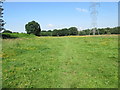
100 photos from this area
Area Information
Key information about the BN5 9RS including its size, population, and administrative classification.
- Area Type
- Postcode
- Area Size
- 22.7 hectares
- Population
- 1530
- Population Density
- 434 people/km²
House Prices in BN5 9RS
18
Properties
£437,875
Average Sold Price
£199,999
Lowest Price
£720,000
Highest Price
Showing 18 properties
| Address | Type | Beds | Baths | Last Sale Price | Last Sale Date | |
|---|---|---|---|---|---|---|
| The White House, Henfield Common South, Henfield, BN5 9RS | Semi-detached | 3 | 2 | £720,000 | Aug 2020 | |
| Garden Cottage, Henfield Common South, Henfield, BN5 9RS | Semi-detached | 4 | 2 | £575,000 | Jan 2015 | |
| Headmasters House, Henfield Common South, Henfield, BN5 9RS | house | 4 | - | £448,000 | Mar 2012 | |
| Crabtree Cottage, Henfield Common South, Henfield, BN5 9RS | house | 4 | - | £500,000 | Nov 2009 | |
| Bell House, Henfield Common South, Henfield, BN5 9RS | Detached | 3 | 2 | £410,000 | Nov 2009 | |
| School House, Henfield Common South, Henfield, BN5 9RS | Semi-detached | 4 | - | £380,000 | Sep 2003 | |
| April Cottage, Henfield Common South, Henfield, BN5 9RS | Semi-detached | - | - | £199,999 | Dec 2001 | |
| Bramblings, Henfield Common South, Henfield, BN5 9RS | Detached | - | - | £270,000 | Dec 1999 | |
| Annexe, East House, Henfield Common South, Henfield, BN5 9RS | Detached | - | - | - | - | |
| The Granary Flat, The Mill House, Henfield Common South, Henfield, BN5 9RS | Detached | - | - | - | - |
Page 1 of 2
Energy Efficiency in BN5 9RS
Amenities
Schools
| Rank | School | Type | Entry gender | Ages |
|---|
Explore more schools in this area
Go to Schools tabDemographics
Household Size
Two person
most common
Accommodation Type
Houses
most common
Tenure
81
majority
Ethnic Group
White
most common
Religion
N/A
most common
Household Composition
N/A
most common
Age
47
median
Elderly (65+ years)
most common
Household Deprivation
N/A
with no deprivation
NS-SEC
46
in Lower managerial occupations
Explore more demographic insights in this area
Go to Demographics tabPlanning
Planning Constraints
- Flood RiskPremium
- Ramsar Wetland SitesPremium
- Area of Outstanding Natural BeautyPremium
- Protected Nature ReservePremium
- Protected WoodlandPremium