Area Overview for BN5 9FG
Photos of BN5 9FG
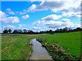
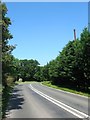
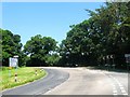
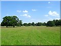
43 photos from this area
Area Information
Key information about the BN5 9FG including its size, population, and administrative classification.
- Area Type
- Postcode
- Area Size
- 18.1 hectares
- Population
- 1900
- Population Density
- 1705 people/km²
House Prices in BN5 9FG
61
Properties
£328,870
Average Sold Price
£250,000
Lowest Price
£493,000
Highest Price
Showing 61 properties
| Address | Type | Beds | Baths | Last Sale Price | Last Sale Date | |
|---|---|---|---|---|---|---|
| 113 Meadow Drive, Henfield, BN5 9FG | house | 4 | 2 | £493,000 | Feb 2022 | |
| 1 Meadow Drive, Henfield, BN5 9FG | Terraced | 4 | 1 | £385,000 | Jun 2021 | |
| 3 Meadow Drive, Henfield, BN5 9FG | house | - | - | £340,000 | Feb 2021 | |
| 45 Meadow Drive, Henfield, BN5 9FG | house | - | - | £385,000 | Jan 2021 | |
| 121 Meadow Drive, Henfield, BN5 9FG | house | - | - | £437,500 | Dec 2020 | |
| 23 Meadow Drive, Henfield, BN5 9FG | Semi-detached | 3 | 2 | £350,000 | Feb 2019 | |
| 33 Meadow Drive, Henfield, BN5 9FG | Semi-detached | 3 | 2 | £372,500 | Oct 2016 | |
| 9 Meadow Drive, Henfield, BN5 9FG | house | - | - | £277,500 | Sep 2014 | |
| 17 Meadow Drive, Henfield, BN5 9FG | house | - | - | £280,000 | May 2014 | |
| 15 Meadow Drive, Henfield, BN5 9FG | house | - | - | £282,000 | May 2014 |
Page 1 of 7
Energy Efficiency in BN5 9FG
Amenities
Schools
| Rank | School | Type | Entry gender | Ages |
|---|
Explore more schools in this area
Go to Schools tabDemographics
Household Size
One person
most common
Accommodation Type
Houses
most common
Tenure
57
majority
Ethnic Group
White
most common
Religion
N/A
most common
Household Composition
N/A
most common
Age
47
median
Adults (30-64 years)
most common
Household Deprivation
N/A
with no deprivation
NS-SEC
35
in Lower managerial occupations
Explore more demographic insights in this area
Go to Demographics tabPlanning
Planning Constraints
- Flood RiskPremium
- Ramsar Wetland SitesPremium
- Area of Outstanding Natural BeautyPremium
- Protected Nature ReservePremium
- Protected WoodlandPremium