Area Overview for BN44 3FB
Photos of BN44 3FB
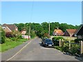
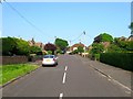
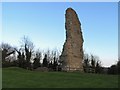
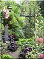
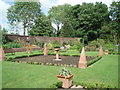
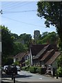
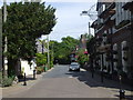
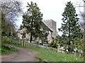
100 photos from this area
Area Information
Key information about the BN44 3FB including its size, population, and administrative classification.
- Area Type
- Postcode
- Area Size
- 1.6 hectares
- Population
- 2377
- Population Density
- 99 people/km²
House Prices in BN44 3FB
15
Properties
£341,028
Average Sold Price
£77,500
Lowest Price
£540,000
Highest Price
Showing 15 properties
| Address | Type | Beds | Baths | Last Sale Price | Last Sale Date | |
|---|---|---|---|---|---|---|
| Castle Lea, Castle Lane, Bramber, BN44 3FB | Semi-detached | 4 | 2 | £475,000 | Aug 2018 | |
| Castle Cottage, Castle Lane, Bramber, BN44 3FB | Cottage | 1 | 1 | £227,500 | May 2014 | |
| Hoppits, Castle Lane, Bramber, BN44 3FB | Bungalow | 3 | - | £330,000 | Nov 2013 | |
| The Elms, Castle Lane, Bramber, BN44 3FB | Semi-detached | 3 | 2 | £375,000 | Nov 2013 | |
| Merlin, Castle Lane, Bramber, BN44 3FB | Bungalow | 3 | 2 | £425,000 | Jul 2011 | |
| Barn End, Castle Lane, Bramber, BN44 3FB | Bungalow | 4 | - | £540,000 | Jul 2010 | |
| St Marys Cottage, Castle Lane, Bramber, BN44 3FB | Detached | - | - | £370,000 | Dec 2008 | |
| Littlebank, Castle Lane, Bramber, BN44 3FB | Semi-detached | - | - | £249,250 | Apr 2004 | |
| Byways, Castle Lane, Bramber, BN44 3FB | Semi-detached | - | - | £77,500 | Nov 2002 | |
| Timberline, Castle Lane, Bramber, BN44 3FB | Detached | 4 | 2 | - | - |
Page 1 of 2
Energy Efficiency in BN44 3FB
Amenities
Schools
| Rank | School | Type | Entry gender | Ages |
|---|
Explore more schools in this area
Go to Schools tabDemographics
Household Size
Two person
most common
Accommodation Type
Houses
most common
Tenure
85
majority
Ethnic Group
White
most common
Religion
N/A
most common
Household Composition
N/A
most common
Age
47
median
Adults (30-64 years)
most common
Household Deprivation
N/A
with no deprivation
NS-SEC
42
in Lower managerial occupations
Explore more demographic insights in this area
Go to Demographics tabPlanning
Planning Constraints
- Flood RiskPremium
- Ramsar Wetland SitesPremium
- Area of Outstanding Natural BeautyPremium
- Protected Nature ReservePremium
- Protected WoodlandPremium