Area Overview for BN43 5RF
Photos of BN43 5RF
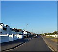

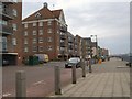
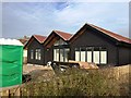
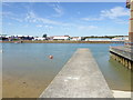
89 photos from this area
Area Information
Key information about the BN43 5RF including its size, population, and administrative classification.
- Area Type
- Postcode
- Area Size
- 1.5 hectares
- Population
- 2423
- Population Density
- 3422 people/km²
House Prices in BN43 5RF
38
Properties
£393,178
Average Sold Price
£70,000
Lowest Price
£1,006,000
Highest Price
Showing 38 properties
| Address | Type | Beds | Baths | Last Sale Price | Last Sale Date | |
|---|---|---|---|---|---|---|
| 13 East Meadway, Shoreham By Sea, BN43 5RF | Bungalow | 3 | 1 | £615,000 | Aug 2024 | |
| 20 East Meadway, Shoreham By Sea, BN43 5RF | Bungalow | 2 | 1 | £250,000 | Nov 2023 | |
| 24 East Meadway, Shoreham By Sea, BN43 5RF | Terraced | 2 | 1 | £360,000 | Jun 2023 | |
| 15 East Meadway, Shoreham By Sea, BN43 5RF | Detached | 4 | 3 | £900,000 | May 2023 | |
| 19 East Meadway, Shoreham By Sea, BN43 5RF | Detached | 4 | 2 | £1,006,000 | Sep 2022 | |
| 36 East Meadway, Shoreham By Sea, BN43 5RF | Retail | 3 | 2 | £725,000 | Sep 2022 | |
| Palmera, 10 East Meadway, Shoreham By Sea, BN43 5RF | house | - | - | £610,000 | Jun 2021 | |
| 11 East Meadway, Shoreham By Sea, BN43 5RF | house | - | - | £540,000 | Apr 2021 | |
| 18 East Meadway, Shoreham By Sea, BN43 5RF | Semi-detached | 2 | 1 | £430,000 | Feb 2021 | |
| 2B East Meadway, Shoreham By Sea, BN43 5RF | Semi-detached | 3 | - | £400,000 | Oct 2017 |
Page 1 of 4
Energy Efficiency in BN43 5RF
Amenities
Schools
| Rank | School | Type | Entry gender | Ages |
|---|
Explore more schools in this area
Go to Schools tabDemographics
Household Size
Two person
most common
Accommodation Type
Houses
most common
Tenure
80
majority
Ethnic Group
White
most common
Religion
N/A
most common
Household Composition
N/A
most common
Age
47
median
Adults (30-64 years)
most common
Household Deprivation
N/A
with no deprivation
NS-SEC
47
in Lower managerial occupations
Explore more demographic insights in this area
Go to Demographics tabPlanning
Planning Constraints
- Flood RiskPremium
- Ramsar Wetland SitesPremium
- Area of Outstanding Natural BeautyPremium
- Protected Nature ReservePremium
- Protected WoodlandPremium