Area Overview for BN43 5JH
Photos of BN43 5JH
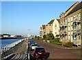
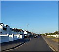
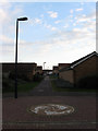
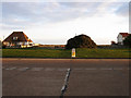
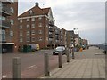
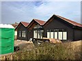
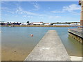
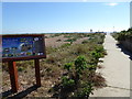
89 photos from this area
Area Information
Key information about the BN43 5JH including its size, population, and administrative classification.
- Area Type
- Postcode
- Area Size
- 4438 m²
- Population
- 2239
- Population Density
- 3457 people/km²
House Prices in BN43 5JH
36
Properties
£187,288
Average Sold Price
£44,500
Lowest Price
£318,000
Highest Price
Showing 36 properties
| Address | Type | Beds | Baths | Last Sale Price | Last Sale Date | |
|---|---|---|---|---|---|---|
| 23, King Charles Place, Emerald Quay, Shoreham By Sea, BN43 5JH | Flat | - | - | £220,000 | Jun 2021 | |
| 27, King Charles Place, Emerald Quay, Shoreham By Sea, BN43 5JH | Flat | 2 | 2 | £218,000 | Feb 2020 | |
| 29, King Charles Place, Emerald Quay, Shoreham By Sea, BN43 5JH | Flat | - | - | £225,000 | Nov 2019 | |
| 33, King Charles Place, Emerald Quay, Shoreham By Sea, BN43 5JH | Flat | - | - | £180,000 | Aug 2019 | |
| 26, King Charles Place, Emerald Quay, Shoreham By Sea, BN43 5JH | Flat | 3 | 3 | £317,500 | Jan 2017 | |
| 28, King Charles Place, Emerald Quay, Shoreham By Sea, BN43 5JH | Flat | 3 | 3 | £318,000 | Sep 2016 | |
| 25, King Charles Place, Emerald Quay, Shoreham By Sea, BN43 5JH | Flat | 2 | 2 | £195,000 | Jan 2016 | |
| 24, King Charles Place, Emerald Quay, Shoreham By Sea, BN43 5JH | Flat | - | - | £151,950 | Feb 2012 | |
| 30, King Charles Place, Emerald Quay, Shoreham By Sea, BN43 5JH | Flat | 2 | 2 | £151,000 | Dec 2011 | |
| 32, King Charles Place, Emerald Quay, Shoreham By Sea, BN43 5JH | Flat | - | - | £123,000 | Feb 2003 |
Page 1 of 4
Energy Efficiency in BN43 5JH
Amenities
Schools
| Rank | School | Type | Entry gender | Ages |
|---|
Explore more schools in this area
Go to Schools tabDemographics
Household Size
Two person
most common
Accommodation Type
Houses
most common
Tenure
71
majority
Ethnic Group
White
most common
Religion
N/A
most common
Household Composition
N/A
most common
Age
47
median
Adults (30-64 years)
most common
Household Deprivation
N/A
with no deprivation
NS-SEC
43
in Lower managerial occupations
Explore more demographic insights in this area
Go to Demographics tabPlanning
Planning Constraints
- Flood RiskPremium
- Ramsar Wetland SitesPremium
- Area of Outstanding Natural BeautyPremium
- Protected Nature ReservePremium
- Protected WoodlandPremium