Area Overview for BN43 5GJ
Photos of BN43 5GJ
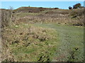
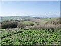
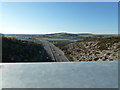
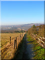


40 photos from this area
Area Information
Key information about the BN43 5GJ including its size, population, and administrative classification.
- Area Type
- Postcode
- Area Size
- 3.1 hectares
- Population
- 1394
- Population Density
- 4119 people/km²
House Prices in BN43 5GJ
47
Properties
£606,341
Average Sold Price
£66,000
Lowest Price
£6,030,000
Highest Price
Showing 47 properties
| Address | Type | Beds | Baths | Last Sale Price | Last Sale Date | |
|---|---|---|---|---|---|---|
| 63 The Avenue, Shoreham By Sea, BN43 5GJ | Terraced | 3 | 1 | £422,000 | Jan 2025 | |
| 31 The Avenue, Shoreham By Sea, BN43 5GJ | Semi-detached | 3 | 1 | £610,000 | Jul 2024 | |
| 57 The Avenue, Shoreham By Sea, BN43 5GJ | Terraced | 3 | 1 | £450,000 | Aug 2023 | |
| 71 The Avenue, Shoreham By Sea, BN43 5GJ | Semi-detached | 3 | 1 | £6,030,000 | Feb 2023 | |
| 73 The Avenue, Shoreham By Sea, BN43 5GJ | Retail | 3 | 1 | £610,000 | Sep 2022 | |
| 59 The Avenue, Shoreham By Sea, BN43 5GJ | house | 3 | 1 | £455,000 | Sep 2022 | |
| 27 The Avenue, Shoreham By Sea, BN43 5GJ | Semi-detached | 4 | 3 | £790,000 | Mar 2021 | |
| 53 The Avenue, Shoreham By Sea, BN43 5GJ | Terraced | 4 | 2 | £445,000 | Jun 2020 | |
| 35 The Avenue, Shoreham By Sea, BN43 5GJ | house | - | - | £899,950 | Mar 2020 | |
| 14 The Avenue, Shoreham By Sea, BN43 5GJ | Semi-detached | 3 | 1 | £460,000 | Aug 2018 |
Page 1 of 5
Energy Efficiency in BN43 5GJ
Amenities
Schools
| Rank | School | Type | Entry gender | Ages |
|---|
Explore more schools in this area
Go to Schools tabDemographics
Household Size
Two person
most common
Accommodation Type
Houses
most common
Tenure
92
majority
Ethnic Group
White
most common
Religion
N/A
most common
Household Composition
N/A
most common
Age
47
median
Adults (30-64 years)
most common
Household Deprivation
N/A
with no deprivation
NS-SEC
48
in Lower managerial occupations
Explore more demographic insights in this area
Go to Demographics tabPlanning
Planning Constraints
- Flood RiskPremium
- Ramsar Wetland SitesPremium
- Area of Outstanding Natural BeautyPremium
- Protected Nature ReservePremium
- Protected WoodlandPremium