Area Overview for BN43 5FN
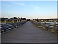
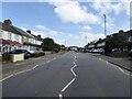
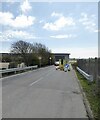
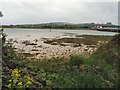
Photos of BN43 5FN


Area Information
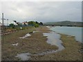
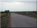
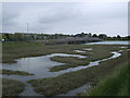
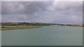
BN43 5FN is a small, tightly knit residential postcode area in West Sussex, England, nestled within the larger parish of Lancing. With a population of 1,511 people spread across 754 individuals per square kilometre, it reflects a compact, suburban character typical of the region. The area benefits from its proximity to Lancing, a coastal village with Saxon roots and a history of market gardening that once supplied Brighton and London. Today, the village has evolved into a quieter, family-oriented community, with a mix of historic and modern housing. Residents enjoy easy access to nearby amenities, including two airports, multiple railway stations, and a range of local shops. The area’s low crime risk and absence of environmental constraints like flood zones or protected nature reserves make it appealing for those seeking a stable, well-connected home. Its small size means the community feels close-knit, with daily life shaped by the surrounding landscapes of the South Downs and the River Adur.
- Area Type
- Postcode
- Area Size
- Not available
- Population
- 1511
- Population Density
- 754 people/km²
The property market in BN43 5FN is characterised by a 48% home ownership rate, with houses forming the predominant type of accommodation. This suggests a mix of owner-occupied properties and rental units, though the relatively low home ownership percentage may indicate a higher proportion of renters or shared ownership models. The small size of the postcode area means the housing stock is limited, potentially making it a competitive market for buyers. The presence of nearby rail stations, including Shoreham and Lancing Railway Station, and proximity to two airports could enhance the area’s appeal for commuters or those requiring frequent travel. However, the lack of specific data on property prices or development trends means buyers should focus on the area’s practical advantages: a low crime rate, minimal environmental risks, and access to local amenities. For those seeking a suburban lifestyle with a balance of convenience and tranquillity, BN43 5FN offers a compact, well-connected option.
House Prices in BN43 5FN
No properties found in this postcode.
Energy Efficiency in BN43 5FN
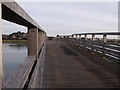
Living in BN43 5FN offers access to a range of practical amenities within easy reach. Local retail options include Waitrose Little Waitrose, Budgens Shoreham, and Co-op Shoreham, providing everyday shopping convenience. The area’s railway stations—Shoreham, Lancing, and Southwick—offer connections to broader networks, while two airports serve those needing air travel. Though the postcode itself is small, its integration with Lancing ensures residents can access the village’s historic churches, like St James the Less, and its legacy as a market gardening hub. The surrounding landscapes of the South Downs and River Adur provide opportunities for outdoor activities, though specific parks or leisure facilities within BN43 5FN are not detailed. The combination of retail, transport, and proximity to natural features creates a lifestyle that balances convenience with the charm of a suburban setting.
Amenities
Schools
| Rank | School | Type | Entry gender | Ages |
|---|
Explore more schools in this area
Go to Schools tabDemographics
BN43 5FN has a median age of 47, with the majority of residents falling within the 30–64 age range. This suggests a mature, established community, likely with a significant number of families and professionals. Home ownership rates stand at 48%, indicating a balanced mix of owner-occupied and rental properties. The area is predominantly composed of houses, reflecting a more traditional housing stock compared to high-density developments. The predominant ethnic group is White, though no specific data on diversity or deprivation levels is provided. The age profile implies a population that may be less reliant on school infrastructure, though nearby Lancing offers educational institutions. The absence of detailed deprivation metrics means the quality of life here cannot be fully assessed, but the low crime score and lack of environmental risks suggest a generally stable environment.
Household Size
Accommodation Type
Tenure
Ethnic Group
Religion
Household Composition
Age
Household Deprivation
NS-SEC
Explore more demographic insights in this area
Go to Demographics tabPlanning
Planning Constraints
- Flood RiskPremium
- Ramsar Wetland SitesPremium
- Area of Outstanding Natural BeautyPremium
- Protected Nature ReservePremium
- Protected WoodlandPremium