Area Overview for BN41 2WE
Photos of BN41 2WE
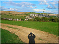
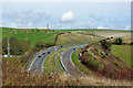
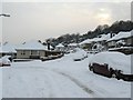
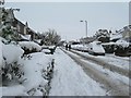
55 photos from this area
Area Information
Key information about the BN41 2WE including its size, population, and administrative classification.
- Area Type
- Postcode
- Area Size
- 4004 m²
- Population
- 1659
- Population Density
- 6599 people/km²
House Prices in BN41 2WE
9
Properties
£251,999
Average Sold Price
£73,500
Lowest Price
£345,000
Highest Price
Showing 9 properties
| Address | Type | Beds | Baths | Last Sale Price | Last Sale Date | |
|---|---|---|---|---|---|---|
| 9 Hillbank Close, Portslade, BN41 2WE | Semi-detached | 2 | 1 | £335,000 | Nov 2024 | |
| 1 Hillbank Close, Portslade, BN41 2WE | house | 4 | - | £315,000 | Mar 2017 | |
| 6 Hillbank Close, Portslade, BN41 2WE | house | 3 | - | £345,000 | Mar 2017 | |
| 5 Hillbank Close, Portslade, BN41 2WE | house | - | - | £282,500 | Feb 2016 | |
| 2 Hillbank Close, Portslade, BN41 2WE | house | 3 | - | £235,000 | Feb 2014 | |
| 7 Hillbank Close, Portslade, BN41 2WE | Detached | - | - | £177,995 | Oct 2003 | |
| 3 Hillbank Close, Portslade, BN41 2WE | house | - | - | £73,500 | Jul 1999 | |
| 4 Hillbank Close, Portslade, BN41 2WE | house | - | - | - | - | |
| 8 Hillbank Close, Portslade, BN41 2WE | Detached | - | - | - | - |
Energy Efficiency in BN41 2WE
Amenities
Schools
| Rank | School | Type | Entry gender | Ages |
|---|
Explore more schools in this area
Go to Schools tabDemographics
Household Size
Family (3-5 people)
most common
Accommodation Type
Houses
most common
Tenure
61
majority
Ethnic Group
White
most common
Religion
N/A
most common
Household Composition
N/A
most common
Age
47
median
Adults (30-64 years)
most common
Household Deprivation
N/A
with no deprivation
NS-SEC
31
in Lower managerial occupations
Explore more demographic insights in this area
Go to Demographics tabPlanning
Planning Constraints
- Flood RiskPremium
- Ramsar Wetland SitesPremium
- Area of Outstanding Natural BeautyPremium
- Protected Nature ReservePremium
- Protected WoodlandPremium