Area Overview for BN41 2TJ
Photos of BN41 2TJ

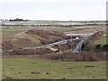
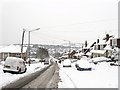
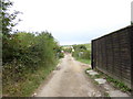
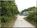
39 photos from this area
Area Information
Key information about the BN41 2TJ including its size, population, and administrative classification.
- Area Type
- Postcode
- Area Size
- 3.0 hectares
- Population
- 1419
- Population Density
- 5483 people/km²
House Prices in BN41 2TJ
42
Properties
£277,012
Average Sold Price
£130,000
Lowest Price
£453,500
Highest Price
Showing 42 properties
| Address | Type | Beds | Baths | Last Sale Price | Last Sale Date | |
|---|---|---|---|---|---|---|
| 212 Valley Road, Portslade, BN41 2TJ | Detached | 3 | 1 | £365,000 | Dec 2025 | |
| 218 Valley Road, Portslade, BN41 2TJ | Semi-detached | 2 | 1 | £390,000 | Dec 2024 | |
| 162 Valley Road, Portslade, BN41 2TJ | Semi-detached | 2 | 1 | £345,000 | Oct 2023 | |
| 206 Valley Road, Portslade, BN41 2TJ | Semi-detached | 2 | 1 | £365,000 | Oct 2023 | |
| 148 Valley Road, Portslade, BN41 2TJ | Semi-detached | 4 | 2 | £422,500 | Oct 2023 | |
| 208 Valley Road, Portslade, BN41 2TJ | Bungalow | - | - | £453,500 | Jul 2022 | |
| 180 Valley Road, Portslade, BN41 2TJ | Bungalow | - | - | £331,300 | Dec 2021 | |
| 214 Valley Road, Portslade, BN41 2TJ | Bungalow | - | - | £365,000 | Aug 2021 | |
| 174 Valley Road, Portslade, BN41 2TJ | Bungalow | - | - | £302,500 | Jun 2021 | |
| 192 Valley Road, Portslade, BN41 2TJ | Bungalow | - | - | £312,000 | Feb 2021 |
Page 1 of 5
Energy Efficiency in BN41 2TJ
Amenities
Schools
| Rank | School | Type | Entry gender | Ages |
|---|
Explore more schools in this area
Go to Schools tabDemographics
Household Size
Family (3-5 people)
most common
Accommodation Type
Houses
most common
Tenure
46
majority
Ethnic Group
White
most common
Religion
N/A
most common
Household Composition
N/A
most common
Age
47
median
Adults (30-64 years)
most common
Household Deprivation
N/A
with no deprivation
NS-SEC
25
in Lower managerial occupations
Explore more demographic insights in this area
Go to Demographics tabPlanning
Planning Constraints
- Flood RiskPremium
- Ramsar Wetland SitesPremium
- Area of Outstanding Natural BeautyPremium
- Protected Nature ReservePremium
- Protected WoodlandPremium