Area Overview for BN41 2GF
Photos of BN41 2GF


Area Information
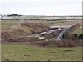
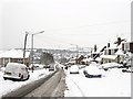
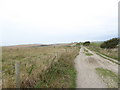
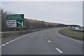
BN41 2GF is a small residential postcode in East Sussex, nestled within the Brighton & Hove unitary authority. With a population of just 1,557, it reflects a tightly knit community shaped by its historical roots in Portslade. The area’s proximity to Mile Oak and its inclusion in the North Portslade Ward highlight its role as a quiet, family-oriented enclave. Residents benefit from a blend of historical charm and modern convenience, with nearby landmarks such as St Andrew’s Church (built 1864) and the A27 by-pass adding to its character. The postcode’s small size means it is a compact, self-contained area, ideal for those seeking a peaceful yet accessible location. Its integration into the Brighton & Hove authority, which gained city status in 2000, ensures proximity to urban amenities without the density of a major city. Daily life here is likely defined by a mix of local traditions, community events, and the ease of access to nearby transport networks, including multiple railway stations and two airports. The area’s low crime risk and absence of environmental constraints further enhance its appeal as a stable, safe place to live.
- Area Type
- Postcode
- Area Size
- Not available
- Population
- Not available
- Population Density
- Not available
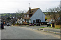
BN41 2GF is primarily an owner-occupied area, with 82% of properties in private hands. The accommodation type is predominantly houses, which is typical of smaller, residential postcodes in the South East. This suggests a market skewed toward family homes and semi-detached or detached properties rather than apartments or rental units. Given the area’s small size, the housing stock is likely limited, making it a niche market for buyers seeking characterful, low-density living. The high home ownership rate indicates that properties here are likely to be long-term investments, with little turnover. For prospective buyers, this means a focus on individual homes rather than speculative development. The absence of planning constraints such as protected woodlands or AONB designations also makes the area more flexible for home improvements or extensions. However, the limited size of the postcode means that buyers should consider the broader Portslade area for additional options. The market’s stability, combined with low crime risk, positions BN41 2GF as a secure, family-friendly choice.
House Prices in BN41 2GF
No properties found in this postcode.
Energy Efficiency in BN41 2GF
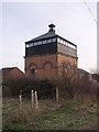
Residents of BN41 2GF have access to a range of amenities within practical reach, enhancing daily life. Retail options include Budgens Valley, Morrisons Daily Portslade 80, and Co-op Portslade, providing essential shopping and grocery needs. The area’s railway stations—Fishersgate, Portslade, and Southwick—offer convenient transport links to nearby towns and cities, while the proximity to Shoreham Brighton City Airport and Shoreham Airport adds to regional connectivity. Though the data does not mention parks or leisure facilities explicitly, the area’s historical sites, such as St Andrew’s Church and Foredown Tower Countryside Centre, suggest opportunities for cultural and recreational activities. The presence of retail and transport hubs indicates a practical, community-focused lifestyle, balancing convenience with the area’s quieter residential character. For those seeking a mix of local amenities and easy access to urban resources, BN41 2GF offers a well-rounded environment.
Amenities
Schools
Residents of BN41 2GF have access to two special schools within practical reach: Downs Park School and Hill Park School. Both institutions cater to students with specific educational needs, offering tailored support and resources. The presence of special schools suggests the area may attract families with children requiring specialist provisions, though no mainstream schools are listed in the data. For parents seeking a range of educational options, the absence of primary or secondary schools in the immediate vicinity could be a consideration. However, the proximity to Portslade and Brighton & Hove means other schools may be accessible via transport links. The mix of school types reflects the area’s focus on inclusivity and support for diverse learning requirements. While the data does not include Ofsted ratings, the existence of these schools underscores the community’s commitment to education and accessibility for all children.
| Rank | School | Type | Entry gender | Ages |
|---|
Explore more schools in this area
Go to Schools tabDemographics
The community in BN41 2GF is predominantly composed of adults aged 30–64, with a median age of 47. This suggests a mature, established population, likely with strong ties to the area. Home ownership is high, with 82% of residents living in their own homes, indicating a stable and long-term demographic. The accommodation type is primarily houses, reflecting a suburban or semi-rural character rather than high-density living. The predominant ethnic group is White, which aligns with broader trends in the region. While specific data on deprivation is not provided, the high home ownership rate and low crime risk (score 92) imply a relatively affluent and secure environment. The absence of significant diversity metrics in the data means the area’s social fabric is largely homogenous. For families or professionals seeking a settled community with minimal turnover, BN41 2GF offers a clear advantage. The age profile also suggests a focus on middle-aged residents, possibly with children or retirees, contributing to a balanced but not overly youthful population.
Household Size
Accommodation Type
Tenure
Ethnic Group
Religion
Household Composition
Age
Household Deprivation
NS-SEC
Explore more demographic insights in this area
Go to Demographics tabPlanning
Planning Constraints
- Flood RiskPremium
- Ramsar Wetland SitesPremium
- Area of Outstanding Natural BeautyPremium
- Protected Nature ReservePremium
- Protected WoodlandPremium