Area Overview for BN41 2FN
Photos of BN41 2FN
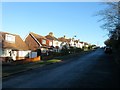
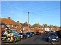
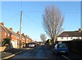
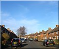

45 photos from this area
Area Information
Key information about the BN41 2FN including its size, population, and administrative classification.
- Area Type
- Postcode
- Area Size
- 1.1 hectares
- Population
- 1587
- Population Density
- 6050 people/km²
House Prices in BN41 2FN
40
Properties
£279,005
Average Sold Price
£55,750
Lowest Price
£418,000
Highest Price
Showing 40 properties
| Address | Type | Beds | Baths | Last Sale Price | Last Sale Date | |
|---|---|---|---|---|---|---|
| 43 Fairway Crescent, Portslade, BN41 2FN | Terraced | 4 | 3 | £358,000 | Dec 2024 | |
| 49 Fairway Crescent, Portslade, BN41 2FN | Terraced | 3 | 1 | £418,000 | May 2024 | |
| 101 Fairway Crescent, Portslade, BN41 2FN | Terraced | 4 | 1 | £408,000 | Sep 2023 | |
| 71 Fairway Crescent, Portslade, BN41 2FN | house | 3 | - | £405,000 | Nov 2021 | |
| 61 Fairway Crescent, Portslade, BN41 2FN | house | - | - | £402,000 | Nov 2020 | |
| 85 Fairway Crescent, Portslade, BN41 2FN | house | - | - | £215,458 | Jun 2019 | |
| 31 Fairway Crescent, Portslade, BN41 2FN | Terraced | 3 | 1 | £327,000 | Jun 2018 | |
| 83 Fairway Crescent, Portslade, BN41 2FN | house | - | - | £363,500 | Sep 2017 | |
| 91 Fairway Crescent, Portslade, BN41 2FN | house | - | - | £395,000 | Aug 2017 | |
| 75 Fairway Crescent, Portslade, BN41 2FN | house | 4 | - | £350,000 | May 2017 |
Page 1 of 4
Energy Efficiency in BN41 2FN
Amenities
Schools
| Rank | School | Type | Entry gender | Ages |
|---|
Explore more schools in this area
Go to Schools tabDemographics
Household Size
Family (3-5 people)
most common
Accommodation Type
Houses
most common
Tenure
69
majority
Ethnic Group
White
most common
Religion
N/A
most common
Household Composition
N/A
most common
Age
47
median
Adults (30-64 years)
most common
Household Deprivation
N/A
with no deprivation
NS-SEC
33
in Lower managerial occupations
Explore more demographic insights in this area
Go to Demographics tabPlanning
Planning Constraints
- Flood RiskPremium
- Ramsar Wetland SitesPremium
- Area of Outstanding Natural BeautyPremium
- Protected Nature ReservePremium
- Protected WoodlandPremium