Area Overview for BN41 2DN
Photos of BN41 2DN
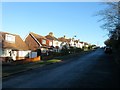
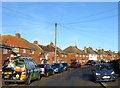
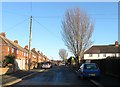
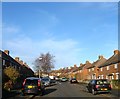
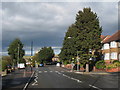
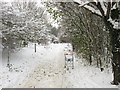
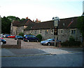
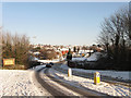
45 photos from this area
Area Information
Key information about the BN41 2DN including its size, population, and administrative classification.
- Area Type
- Postcode
- Area Size
- 4.0 hectares
- Population
- 1604
- Population Density
- 4331 people/km²
House Prices in BN41 2DN
25
Properties
£512,235
Average Sold Price
£128,000
Lowest Price
£860,000
Highest Price
Showing 25 properties
| Address | Type | Beds | Baths | Last Sale Price | Last Sale Date | |
|---|---|---|---|---|---|---|
| 45 Benfield Way, Portslade, BN41 2DN | Detached | 4 | 2 | £775,000 | Mar 2025 | |
| 37 Benfield Way, Portslade, BN41 2DN | Detached | 4 | 2 | £790,000 | Aug 2024 | |
| 77 Benfield Way, Portslade, BN41 2DN | Bungalow | 3 | 1 | £525,000 | Feb 2023 | |
| 35 Benfield Way, Portslade, BN41 2DN | Detached | 5 | 2 | £860,000 | Feb 2023 | |
| 33 Benfield Way, Portslade, BN41 2DN | Detached | 4 | 2 | £630,000 | Jan 2022 | |
| 53 Benfield Way, Portslade, BN41 2DN | Detached | 3 | - | £690,000 | Feb 2020 | |
| 43 Benfield Way, Portslade, BN41 2DN | Bungalow | 3 | 1 | £485,000 | Dec 2017 | |
| 65 Benfield Way, Portslade, BN41 2DN | Detached | 3 | 2 | £525,000 | Apr 2017 | |
| 61 Benfield Way, Portslade, BN41 2DN | house | - | - | £680,000 | Sep 2015 | |
| 55 Benfield Way, Portslade, BN41 2DN | Detached | 3 | - | £465,000 | Feb 2015 |
Page 1 of 3
Energy Efficiency in BN41 2DN
Amenities
Schools
| Rank | School | Type | Entry gender | Ages |
|---|
Explore more schools in this area
Go to Schools tabDemographics
Household Size
Family (3-5 people)
most common
Accommodation Type
Houses
most common
Tenure
88
majority
Ethnic Group
White
most common
Religion
N/A
most common
Household Composition
N/A
most common
Age
47
median
Adults (30-64 years)
most common
Household Deprivation
N/A
with no deprivation
NS-SEC
37
in Lower managerial occupations
Explore more demographic insights in this area
Go to Demographics tabPlanning
Planning Constraints
- Flood RiskPremium
- Ramsar Wetland SitesPremium
- Area of Outstanding Natural BeautyPremium
- Protected Nature ReservePremium
- Protected WoodlandPremium