Area Overview for BN41 1WX
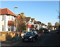
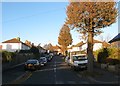
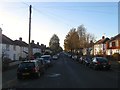
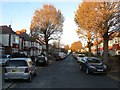
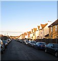
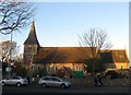
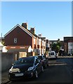
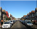
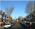
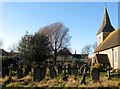
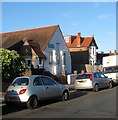
Photos of BN41 1WX

Area Information
BN41 1WX is a small residential postcode area nestled within the Portslade district of Brighton and Hove, a city in the South East of England. With a population of 1,853, it reflects a compact, community-focused cluster of homes. The area sits on the western edge of Brighton, historically tied to Portslade’s industrial past, which included breweries, rail infrastructure, and a once-thriving port. Today, it balances that heritage with modern living, offering proximity to both urban amenities and quieter residential pockets. The area’s character is shaped by its location near key transport hubs, including multiple railway stations, and its access to nearby retail and leisure facilities. While the population is relatively small, the area is part of a larger electoral ward with a 2021 census population of nearly 10,000, suggesting BN41 1WX is a sub-division of a broader, more established community. For those considering living here, the blend of historical context and practical connectivity makes it a niche but viable option, particularly for buyers seeking a quieter slice of Brighton’s suburban edge.
- Area Type
- Postcode
- Area Size
- Not available
- Population
- Not available
- Population Density
- Not available
BN41 1WX is predominantly a home-owning area, with 61% of properties owned by residents rather than rented. The housing stock is largely composed of houses, which is unusual for a postcode area of this size but reflects the broader trend in Portslade’s residential development. This suggests a focus on single-family homes, likely appealing to families or individuals seeking more space. Given the small size of the area, the property market may be limited in scope, with buyers potentially looking to adjacent postcode areas for additional options. The dominance of owner-occupied homes implies a stable, long-term resident base, which can be a positive indicator for property value retention. However, the lack of rental properties may also mean fewer short-term investment opportunities for buyers seeking turnover.
House Prices in BN41 1WX
No properties found in this postcode.
Energy Efficiency in BN41 1WX
BN41 1WX offers a range of nearby amenities within practical reach, enhancing daily life for residents. The area is close to five retail outlets, including major stores like Tesco Portslade, Iceland Portslade, and Aldi Portslade, ensuring convenience for grocery shopping. The presence of multiple railway stations, such as Portslade and Southwick, facilitates easy travel to Brighton’s city centre and beyond. Additionally, proximity to two airports—Shoreham Brighton City Airport and Shoreham Airport—provides added connectivity for those requiring frequent air travel. The main shopping area, Station Road, straddles the Portslade-Hove boundary, offering further retail and dining options. While the data does not specify parks or leisure facilities, the historical context of the area suggests a mix of residential and former industrial spaces that may include green spaces or community areas.
Amenities
Schools
The nearest school to BN41 1WX is St Peter’s Community Primary School, a primary education institution serving the local area. While no Ofsted rating is provided, the presence of a primary school indicates that the area is suitable for families with young children. The absence of secondary schools or additional educational institutions in the immediate vicinity means parents may need to consider nearby postcode areas for broader schooling options. The single school listed suggests a focus on primary education, which could be a consideration for families planning long-term residency. However, the data does not specify whether the school is state-funded or independent, nor its capacity or catchment area.
| Rank | School | Type | Entry gender | Ages |
|---|
Explore more schools in this area
Go to Schools tabDemographics
BN41 1WX has a median age of 47, with the majority of residents falling within the 30-64 age range. This suggests a mature, stable population, likely composed of families and long-term residents. Home ownership rates stand at 61%, indicating a strong presence of owner-occupied properties, which is typical for residential areas with established housing stock. The predominant accommodation type is houses, which aligns with the area’s character as a low-density, residential cluster. The predominant ethnic group is White, reflecting broader demographic trends in the Brighton and Hove region. While no specific data on deprivation is provided, the high home ownership rate and age profile suggest a community with relatively stable economic conditions. However, the absence of detailed diversity statistics means the full scope of the area’s social composition remains partially unexplored.
Household Size
Accommodation Type
Tenure
Ethnic Group
Religion
Household Composition
Age
Household Deprivation
NS-SEC
Explore more demographic insights in this area
Go to Demographics tabPlanning
Planning Constraints
- Flood RiskPremium
- Ramsar Wetland SitesPremium
- Area of Outstanding Natural BeautyPremium
- Protected Nature ReservePremium
- Protected WoodlandPremium