Area Overview for BN41 1TE
Photos of BN41 1TE

Area Information
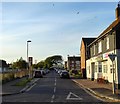
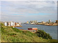
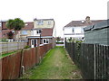
BN41 1TE is a small residential postcode in England, nestled on the western edge of Brighton and Hove. With a population of 1,524, it forms part of the historic Portslade area, a district with roots stretching back to the Domesday Book. The area blends historical charm with modern convenience, centred around coordinates 50.835238, -0.206362. Neighbouring areas include Hove and Southwick, creating a dynamic mix of urban and suburban living. The community has evolved from its 19th-century industrial past—once home to breweries and railway goods hubs—into a quieter residential enclave. Today, it offers a compact, walkable environment with easy access to nearby amenities. The median age of 47 suggests a stable, mature population, many of whom are likely long-term residents. This area is ideal for those seeking a balance between historical character and practicality, with proximity to transport links and a low crime score of 73. Its small size means a tight-knit community feel, though it remains connected to the broader Brighton and Hove network.
- Area Type
- Postcode
- Area Size
- Not available
- Population
- 1524
- Population Density
- 6767 people/km²
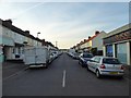
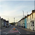
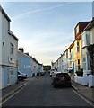
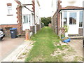
BN41 1TE is primarily an owner-occupied area, with 70% of homes owned by residents rather than rented. The accommodation type is predominantly houses, which is uncommon in many urban areas but aligns with the historical character of Portslade. This suggests a community of homeowners seeking larger, more private living spaces. The small postcode area means property stock is limited, making it a niche market for buyers prioritising specific locations. The absence of flats or high-density housing indicates a focus on individual homes, possibly with gardens or larger plots. For buyers, this could mean higher competition for available properties, but also fewer planning restrictions. The area’s proximity to transport links and amenities may appeal to those seeking a balance between residential tranquillity and urban connectivity.
House Prices in BN41 1TE
No properties found in this postcode.
Energy Efficiency in BN41 1TE
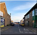
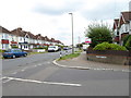
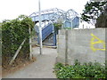
Living in BN41 1TE offers access to a range of nearby amenities, including five retail outlets such as Spar, The Southern Co-operative Co, and Aldi Portslade, ensuring daily shopping needs are met. The area’s rail network includes five stations, providing easy access to Brighton and Hove, while two airports nearby cater to regional travel. Station Road is the main commercial artery, straddling the Portslade-Hove boundary and serving as a focal point for local activity. Though specific parks or leisure facilities are not detailed, the area’s historical character includes landmarks like St Nicolas Church and the former Southdown Brewery, now a factory. The mix of retail, transport, and historical sites creates a convenient, community-oriented lifestyle.
Amenities
Schools
| Rank | School | Type | Entry gender | Ages |
|---|
Explore more schools in this area
Go to Schools tabDemographics
The population of BN41 1TE is predominantly adults aged 30–64, reflecting a mature demographic with a median age of 47. Home ownership is high, at 70%, indicating a stable, long-term resident base. The area is characterised by houses rather than flats, suggesting a mix of family homes and single-occupancy properties. The predominant ethnic group is White, though specific data on diversity or deprivation is not available. This age profile implies a community with established careers and families, likely valuing stability and proximity to services. The high home ownership rate suggests limited rental activity, which may influence property values and local dynamics. With no data on income distribution or deprivation, it is difficult to assess economic diversity, but the absence of protected areas or planning constraints may contribute to a more straightforward housing market.
Household Size
Accommodation Type
Tenure
Ethnic Group
Religion
Household Composition
Age
Household Deprivation
NS-SEC
Explore more demographic insights in this area
Go to Demographics tabPlanning
Planning Constraints
- Flood RiskPremium
- Ramsar Wetland SitesPremium
- Area of Outstanding Natural BeautyPremium
- Protected Nature ReservePremium
- Protected WoodlandPremium