Area Overview for BN4 5TT
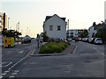
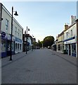
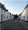
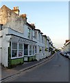
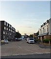
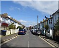
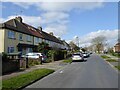
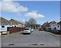
Photos of BN4 5TT


Area Information
BN4 5TT is a small residential postcode area in England, home to 1,871 people. It is a compact cluster of properties, likely centred around a specific localised community. The area’s demographic profile suggests a mature population, with a median age of 47 and the majority of residents aged between 30 and 64. This indicates a stable, established community with a strong presence of adults in their prime working years. The area is characterised by a mix of owner-occupied and rental properties, with flats making up the predominant accommodation type. While specific historical or cultural context is not provided, the proximity to Shoreham and Lancing railway stations, along with two nearby airports, suggests it is well-connected to broader regional networks. Daily life in BN4 5TT is likely shaped by its small-scale nature, with residents relying on nearby amenities such as local shops, transport links, and recreational spaces. The area’s safety profile, however, includes a critical warning about crime, which would be a key consideration for prospective residents.
- Area Type
- Postcode
- Area Size
- Not available
- Population
- 1871
- Population Density
- 6368 people/km²
The property market in BN4 5TT is defined by a 53% home ownership rate, meaning nearly half of the area’s properties are owner-occupied, while the remaining 47% are likely rental properties. The accommodation type is predominantly flats, which may indicate a focus on smaller, more compact housing units. This could suggest a market that caters to individuals or couples rather than larger families, though the data does not specify the proportion of one- or two-bedroom properties. The small size of the area, combined with its proximity to transport links such as railway stations and airports, may make it an attractive option for commuters or those seeking convenience. However, the limited data on property types and sizes means it is difficult to assess the full range of options available. Buyers should consider whether flats align with their needs, as the area does not appear to have a significant presence of larger homes or detached properties.
House Prices in BN4 5TT
No properties found in this postcode.
Energy Efficiency in BN4 5TT
Residents of BN4 5TT have access to a range of nearby amenities within practical reach. The area includes five retail outlets, such as Co-op Shoreham and Waitrose Little Waitrose, providing essential shopping and grocery options. Three railway stations—Shoreham, Lancing, and Southwick—offer convenient access to local and regional transport networks, while two airports—Shoreham Brighton City Airport and Shoreham Airport—cater to those requiring air travel. Although the data does not specify parks or leisure facilities, the proximity to transport and retail suggests a functional, commuter-friendly lifestyle. The presence of multiple retail and transport hubs indicates a community that prioritises accessibility and practicality. However, the lack of detailed information on recreational or cultural amenities means it is unclear whether the area offers a broader range of leisure opportunities beyond its immediate practical needs.
Amenities
Schools
| Rank | School | Type | Entry gender | Ages |
|---|
Explore more schools in this area
Go to Schools tabDemographics
BN4 5TT has a median age of 47, with the most common age range being adults aged 30–64. This suggests a community of working-age individuals and families, though the absence of data on younger or older demographics means the full age distribution is unclear. Home ownership in the area stands at 53%, indicating a mix of owner-occupied and rental properties. The predominant accommodation type is flats, which may reflect a focus on high-density housing or older developments. The predominant ethnic group is White, though no specific data on diversity or minority representation is provided. The lack of detailed information on deprivation or socio-economic factors means it is difficult to assess how these factors might influence quality of life. However, the presence of 53% home ownership and a mature age profile may suggest a relatively stable economic environment, though this is not explicitly confirmed by the data.
Household Size
Accommodation Type
Tenure
Ethnic Group
Religion
Household Composition
Age
Household Deprivation
NS-SEC
Explore more demographic insights in this area
Go to Demographics tabPlanning
Planning Constraints
- Flood RiskPremium
- Ramsar Wetland SitesPremium
- Area of Outstanding Natural BeautyPremium
- Protected Nature ReservePremium
- Protected WoodlandPremium