Area Overview for BN4 5HT
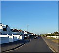
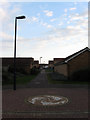
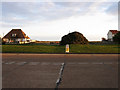
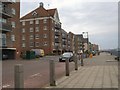
Photos of BN4 5HT
Area Information
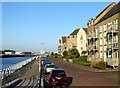
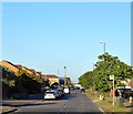
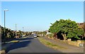
BN4 5HT lies in the Marine district of Worthing Borough Council, a small residential cluster in West Sussex. With a population of 2,423, it is a compact area where daily life is shaped by proximity to both coastal and inland amenities. The postcode sits near the coordinates 50.829763, -0.260533, placing it close to Brighton and Hove’s coastal sites, though it remains distinct as part of the Marine ward. This area is characterised by its mix of established housing and practical infrastructure. Residents benefit from nearby retail hubs, rail links, and two airports, making it a convenient base for commuters or those seeking access to regional transport networks. The low crime risk score of 90 and minimal environmental constraints suggest a stable, low-stress living environment. While not a coastal postcode itself, its location near Black Rock’s Marine Gate (BN2 5TN) hints at the broader appeal of the region’s coastal offerings. For buyers, BN4 5HT represents a blend of suburban comfort and accessibility, ideal for those prioritising safety, connectivity, and a sense of community.
- Area Type
- Postcode
- Area Size
- Not available
- Population
- 2423
- Population Density
- 3422 people/km²
The property market in BN4 5HT is dominated by owner-occupied homes, with 80% of residences owned outright. This high rate of home ownership points to a community of long-term residents rather than a rental market. The accommodation type is primarily houses, which is unusual for areas with higher density, suggesting a suburban or semi-rural character. This housing stock may appeal to buyers seeking larger properties with more space, though the small area size means the market is limited. The proximity to rail stations and airports indicates that properties here are often chosen for their connectivity rather than purely for residential space. Buyers should consider the limited availability of properties and the potential for long-term value retention in a stable, low-risk area.
House Prices in BN4 5HT
No properties found in this postcode.
Energy Efficiency in BN4 5HT
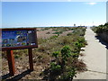
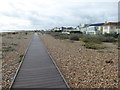
Living in BN4 5HT provides access to a range of amenities within practical reach. Retail options include Lidl Shoreham, Co-op Shoreham, and Tesco Upper, offering everyday shopping convenience. The rail network, with stations such as Shoreham and Southwick, connects residents to broader transport routes. Nearby airports, including Shoreham Brighton City Airport, provide additional travel flexibility. While the area lacks extensive parks or leisure facilities, its proximity to coastal sites like Black Rock suggests opportunities for outdoor activities beyond the immediate postcode. The combination of retail, rail, and air connectivity creates a lifestyle that balances local convenience with regional accessibility. For residents, this means a practical, efficient daily routine with minimal need to travel far for essentials or travel.
Amenities
Schools
The nearest school to BN4 5HT is Shoreham Beach Primary School, which serves the local community with a primary education offering. Its Ofsted rating of ‘good’ indicates a satisfactory standard of teaching and facilities. While no secondary schools are listed in the data, the presence of a primary school suggests that families may rely on nearby institutions in adjacent areas for secondary education. The absence of additional schools in the immediate vicinity means parents may need to consider commuting for higher education. However, the ‘good’ rating at Shoreham Beach Primary School provides reassurance for those prioritising quality early education. The single school listed reflects the area’s small size, which may limit options but ensures a focused, community-oriented educational environment.
| Rank | School | Type | Entry gender | Ages |
|---|
Explore more schools in this area
Go to Schools tabDemographics
BN4 5HT has a median age of 47, with the majority of residents falling within the 30-64 age range. This suggests a mature, established community with a focus on stability. Home ownership is high at 80%, indicating a strong presence of long-term residents rather than transient renters. The area is predominantly composed of houses, which aligns with the demographic profile of older, family-oriented households. The predominant ethnic group is White, reflecting the broader trends in South East England. There is no specific data on deprivation levels, but the high home ownership and low crime risk suggest a relatively affluent or stable socioeconomic environment. The absence of significant diversity data means the community’s composition remains largely homogenous. For buyers, this profile may appeal to those seeking a settled, low-risk environment with a clear sense of neighbourhood continuity.
Household Size
Accommodation Type
Tenure
Ethnic Group
Religion
Household Composition
Age
Household Deprivation
NS-SEC
Explore more demographic insights in this area
Go to Demographics tabPlanning
Planning Constraints
- Flood RiskPremium
- Ramsar Wetland SitesPremium
- Area of Outstanding Natural BeautyPremium
- Protected Nature ReservePremium
- Protected WoodlandPremium