Area Overview for BN4 5HS
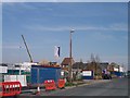
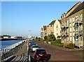
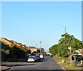
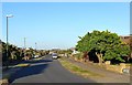
Photos of BN4 5HS
Area Information
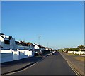
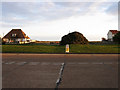
BN4 5HS is a small, tightly knit residential area in West Sussex, falling within the Marine district council ward under Worthing Borough Council. With a population of 2,423, it occupies a distinct position near the coordinates 50.829763, -0.260533, close to coastal sites associated with Brighton and Hove, such as Black Rock. The area is part of the East Worthing and Shoreham constituency, blending suburban comfort with proximity to the South Coast. Daily life here is characterised by a quiet, stable environment, with residents benefiting from nearby amenities and transport links. The postcode area’s small size fosters a close-knit community, where familiar faces and local traditions are common. Its location offers a balance between accessibility to urban centres and the tranquillity of a smaller residential cluster. For those seeking a peaceful yet connected lifestyle, BN4 5HS provides a foundation of stability, supported by low crime rates and minimal environmental risks.
- Area Type
- Postcode
- Area Size
- Not available
- Population
- 2423
- Population Density
- 3422 people/km²
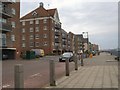
BN4 5HS is primarily an owner-occupied area, with 80% of homes owned by residents rather than rented out. The accommodation type is predominantly houses, which suggests a market focused on family homes and larger properties. This contrasts with areas dominated by rental properties or smaller units. Given the small size of the postcode area, the housing stock is limited, making it a niche market for buyers seeking stability in a low-turnover environment. The high home ownership rate indicates a community with long-term residency, which can contribute to property value retention. For buyers, the focus on houses means fewer options for flats or apartments, but the area’s proximity to transport links and amenities may offset this. The lack of planning constraints, such as protected nature reserves or AONB coverage, also makes it attractive for those seeking straightforward property transactions.
House Prices in BN4 5HS
No properties found in this postcode.
Energy Efficiency in BN4 5HS
BN4 5HS offers a range of local amenities within practical reach, enhancing daily life for residents. The retail sector includes notable stores such as Lidl Shoreham, Co-op Shoreham, and Tesco Upper, providing access to groceries and everyday essentials. The area’s rail stations, including Shoreham and Southwick, facilitate travel to nearby destinations, while the proximity to Shoreham Brighton City Airport and Shoreham Airport caters to those with travel needs. Though the data does not specify parks or leisure facilities, the presence of retail and transport options suggests a lifestyle focused on convenience and accessibility. The combination of local shops and transport links allows residents to manage errands, social activities, and commuting efficiently, contributing to a balanced suburban existence.
Amenities
Schools
The nearest school to BN4 5HS is Shoreham Beach Primary School, which serves the local community with a primary education offering. Its Ofsted rating of ‘good’ reflects a satisfactory standard of teaching and facilities. While no secondary schools are listed in the data, the presence of a primary school suggests that families with younger children may find the area suitable for their needs. The single school in the immediate vicinity indicates a focused educational provision for early years, though parents seeking a broader range of schools may need to look further afield. The ‘good’ rating provides reassurance about the quality of education, though further details on curriculum or extracurricular activities are not available.
| Rank | School | Type | Entry gender | Ages |
|---|
Explore more schools in this area
Go to Schools tabDemographics
The demographic profile of BN4 5HS is defined by a median age of 47, with the majority of residents falling within the 30-64 age range. This suggests a community skewed towards adults, likely including families and professionals. Home ownership is high at 80%, indicating a strong presence of long-term residents and a stable housing market. The predominant accommodation type is houses, reflecting a residential area with larger properties rather than apartments or flats. The predominant ethnic group is White, though no further breakdown of diversity is provided. The absence of specific data on deprivation means that quality of life is inferred from other metrics, such as safety and connectivity. With a population of 2,423, the area is small enough to maintain a cohesive social fabric while offering the practicality of suburban living.
Household Size
Accommodation Type
Tenure
Ethnic Group
Religion
Household Composition
Age
Household Deprivation
NS-SEC
Explore more demographic insights in this area
Go to Demographics tabPlanning
Planning Constraints
- Flood RiskPremium
- Ramsar Wetland SitesPremium
- Area of Outstanding Natural BeautyPremium
- Protected Nature ReservePremium
- Protected WoodlandPremium