Area Overview for BN4 1YF
Photos of BN4 1YF

Area Information
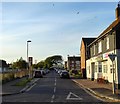
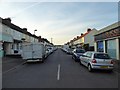
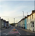
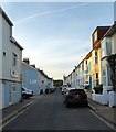
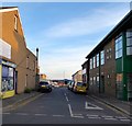
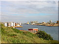
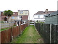
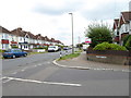
BN4 1YF lies within the Portslade area of Brighton and Hove, a historically significant district with a population of 1,634. This small residential cluster sits on the western edge of the city, blending historical charm with modern convenience. The area’s character is shaped by its past as an industrial hub, now transformed into a community with a mix of older homes and a focus on local amenities. Residents benefit from proximity to rail networks, retail outlets, and schools, while the area’s low crime rate and flood risk make it appealing. Though modest in size, BN4 1YF offers a compact, self-contained lifestyle, with easy access to Brighton’s cultural and economic centres. Its location near Portslade’s main thoroughfares and nearby stations ensures connectivity without the congestion of city centres. The area’s appeal lies in its balance of quiet residential living and practical access to services, making it suitable for families and professionals seeking a stable, community-focused environment.
- Area Type
- Postcode
- Area Size
- Not available
- Population
- 1634
- Population Density
- 6863 people/km²
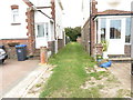
BN4 1YF is characterised by a housing stock dominated by individual homes, with 57% of properties owner-occupied. This suggests a community where long-term residency is common, though the relatively low home ownership rate (compared to national averages) hints at a rental market component. The area’s small size means property availability is limited, which could drive competition among buyers. Given the prevalence of houses, the market likely caters to families seeking space, though the lack of specific data on property sizes or price ranges means potential buyers must consider broader regional trends. The area’s proximity to Brighton and Hove’s amenities, combined with its safety profile, may make it attractive to those prioritising security and convenience over larger urban offerings. However, buyers should be mindful of the area’s compact nature, which may restrict options for larger or more specialised properties.
House Prices in BN4 1YF
No properties found in this postcode.
Energy Efficiency in BN4 1YF
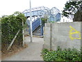
BN4 1YF offers a range of amenities within practical reach, enhancing daily life for residents. The area’s retail options include major chains like Tesco Portslade, The Southern Co-operative Co, and Aldi Portslade, ensuring convenience for grocery shopping. Nearby rail stations, such as Portslade and Southwick, provide easy access to Brighton’s cultural and commercial centres. The proximity to Shoreham airports adds to the area’s connectivity for travel. While the data does not specify parks or leisure facilities, the area’s historical character, including landmarks like St Nicolas Church and former industrial sites, suggests a blend of heritage and community spaces. The presence of multiple retail and transport options, combined with the area’s safety profile, creates a lifestyle that balances practicality with a sense of local identity.
Amenities
Schools
The nearest school to BN4 1YF is St Mary’s Catholic Primary School, a primary institution with an Ofsted rating of ‘good’. This school serves the local community, offering education for younger children in a setting that combines religious values with academic standards. The absence of secondary schools in the immediate vicinity means families may need to consider commuting to nearby areas for secondary education. However, the ‘good’ rating indicates a reliable foundation for early education, which is a key consideration for families prioritising school quality. The single school listed reflects the area’s small size, though its performance suggests a focus on nurturing a strong educational start for residents. Parents should evaluate transport options to secondary schools in Portslade or Hove when planning long-term needs.
| Rank | School | Type | Entry gender | Ages |
|---|
Explore more schools in this area
Go to Schools tabDemographics
BN4 1YF has a median age of 47, with the majority of residents aged 30–64. This suggests a community of established professionals and families, rather than a transient population. Home ownership stands at 57%, indicating a mix of owner-occupied properties and rental stock. The area is predominantly composed of houses, reflecting a more traditional housing stock compared to high-density developments. The predominant ethnic group is White, though no specific data on diversity or deprivation is provided. The age profile implies a stable demographic, with fewer young children or retirees compared to other areas. This balance may influence local services and amenities, catering to middle-aged residents with established needs. The lack of specific data on deprivation means quality of life factors like access to healthcare or social services remain unquantified, though the area’s low crime rate and safety assessments suggest a generally secure environment.
Household Size
Accommodation Type
Tenure
Ethnic Group
Religion
Household Composition
Age
Household Deprivation
NS-SEC
Explore more demographic insights in this area
Go to Demographics tabPlanning
Planning Constraints
- Flood RiskPremium
- Ramsar Wetland SitesPremium
- Area of Outstanding Natural BeautyPremium
- Protected Nature ReservePremium
- Protected WoodlandPremium