Area Overview for BN4 1PX
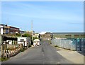
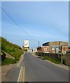
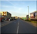
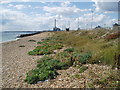
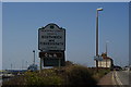
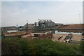
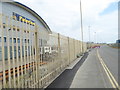
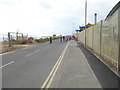
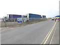
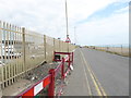
Photos of BN4 1PX


Area Information
BN4 1PX is a small residential postcode area in the Adur District of West Sussex, nestled near Brighton. With a population of 1,758, it forms part of the Eastbrook Ward, a locality characterised by its proximity to the Southwick area. The area is defined by its compact size, offering a quiet, residential cluster rather than a sprawling urban environment. Residents here benefit from being close to Brighton’s amenities while retaining a distinct, localised feel. The demographic profile suggests a mature community, with a median age of 47 and a majority of adults aged 30–64. This age range indicates a stable population, likely with established families and professionals. The area’s small scale means it is not densely populated, contributing to a sense of intimacy. While the data does not specify the exact area size, the postcode’s limited population suggests a tightly knit neighbourhood. Its location in West Sussex, bordered by Hampshire and Surrey, positions it as a gateway to both coastal and inland settings. For buyers, BN4 1PX offers a blend of residential tranquillity and proximity to larger urban centres, though its size means it is best suited for those prioritising community over expansive space.
- Area Type
- Postcode
- Area Size
- Not available
- Population
- Not available
- Population Density
- Not available
The property market in BN4 1PX is characterised by a 45% home ownership rate, indicating that less than half of properties are owner-occupied, with the remainder likely in rental or leasehold. The accommodation type is predominantly houses, which is notable in a region where semi-detached or terraced housing is common. This suggests a niche market catering to buyers seeking single-family homes, though the small area size means the housing stock is limited. The low population density and focus on houses imply that the area is not a hotspot for investment or speculative buying, but rather a place where properties are held long-term. For buyers, this means competition may be limited, but the immediate surroundings—such as nearby wards in Adur District—could offer more options. The lack of data on property prices or recent transactions means the market’s strength or weakness remains unclear, but the focus on owner-occupied homes suggests a steady, if modest, demand.
House Prices in BN4 1PX
No properties found in this postcode.
Energy Efficiency in BN4 1PX
The lifestyle in BN4 1PX is shaped by its proximity to key amenities. Residents can access Fishersgate Railway Station, Portslade, and Southwick stations, which connect to Brighton and other regional hubs. Retail options include Spar, The Southern Co-operative Co, and Tesco Portslade, providing convenience for daily shopping. For travel, Shoreham Brighton City Airport and Shoreham Airport are within reach, though their usage depends on individual needs. The area’s small size means it lacks large parks or leisure facilities, but its integration with nearby wards in Adur District may offer more extensive recreational opportunities. The presence of a primary school and nearby retail hubs suggests a functional, if modest, lifestyle. However, the absence of detailed data on dining or cultural amenities means the area’s character beyond practicality remains unclear. For those prioritising convenience and connectivity, BN4 1PX offers a baseline of services, though its charm may lie in its quiet, residential nature rather than its vibrancy.
Amenities
Schools
The nearest school to BN4 1PX is Fishersgate First School, a primary institution serving the local community. No secondary schools are listed in the data, which means families with older children may need to look beyond the immediate area for secondary education. The presence of a primary school is a key consideration for families with young children, though the absence of secondary options could be a limitation. The school’s specific Ofsted rating is not provided, so its performance cannot be assessed. For prospective buyers, the availability of a primary school is a practical advantage, but the need to travel for secondary education may influence decisions about long-term suitability. The data does not indicate whether the school is oversubscribed or has capacity, but its existence suggests the area is served by at least one educational institution for younger students.
| Rank | School | Type | Entry gender | Ages |
|---|
Explore more schools in this area
Go to Schools tabDemographics
The community in BN4 1PX is predominantly composed of adults aged 30–64, with a median age of 47. This suggests a mature, stable population, likely with long-term residents rather than a transient demographic. Home ownership stands at 45%, indicating a mix of owner-occupied properties and rental units. The accommodation type is primarily houses, which contrasts with areas dominated by flats or apartments. The predominant ethnic group is White, though no specific data on diversity or minority representation is provided. The absence of detailed information on deprivation or income levels means the quality of life cannot be fully assessed, but the age profile and home ownership rate imply a community with established economic stability. The relatively high proportion of adults suggests a lower presence of young families or students, though this is not definitive. The area’s small size and limited data mean its social dynamics remain underexplored, but the demographic structure points to a cohesive, low-mobility population.
Household Size
Accommodation Type
Tenure
Ethnic Group
Religion
Household Composition
Age
Household Deprivation
NS-SEC
Explore more demographic insights in this area
Go to Demographics tabPlanning
Planning Constraints
- Flood RiskPremium
- Ramsar Wetland SitesPremium
- Area of Outstanding Natural BeautyPremium
- Protected Nature ReservePremium
- Protected WoodlandPremium