Area Overview for BN3 7LX
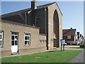
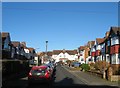
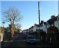
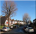
Photos of BN3 7LX
Area Information
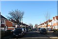
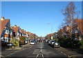
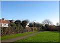
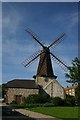
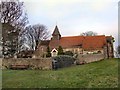
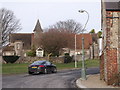
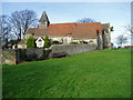
BN3 7LX lies within the Hangleton & Knoll ward of Brighton & Hove, a suburban area shaped by 20th-century development around historic sites like St Helen’s Church and Hangleton Manor. With a population of 1,588, it is a small, tight-knit residential cluster characterised by terraced and semi-detached homes, bungalows, and council housing from the 1930s–1950s. The area blends practicality with charm, offering views of the South Downs and proximity to the sea. Daily life here is defined by a mix of families, retirees, and long-term residents, with local amenities like shops, pubs, and schools within easy reach. The ward’s history as a medieval village, though diminished by plague and poor harvests, now supports a modern community with a focus on stability and accessibility. Its location near major roads and rail links ensures connectivity to Brighton’s cultural hubs while retaining a quieter, suburban atmosphere. For those seeking a balance between convenience and tranquillity, BN3 7LX offers a distinct blend of heritage and contemporary living.
- Area Type
- Postcode
- Area Size
- Not available
- Population
- Not available
- Population Density
- Not available
BN3 7LX is predominantly an owner-occupied area, with 72% of homes owned by residents rather than rented. The housing stock is dominated by houses, likely semi-detached or terraced properties built in the mid-20th century, reflecting the ward’s post-war development. This contrasts with areas dominated by flats or newer builds, suggesting a more traditional, family-oriented market. The small size of the postcode area means the housing stock is limited, and buyers may need to consider nearby suburbs for more options. The mix of council housing and private homes indicates a range of property types, though the absence of data on prices or recent developments means the market’s dynamism remains unclear. For those seeking stability, the high ownership rate and established housing stock make BN3 7LX a predictable, if modest, investment.
House Prices in BN3 7LX
No properties found in this postcode.
Energy Efficiency in BN3 7LX
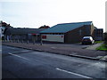
BN3 7LX offers a practical, suburban lifestyle with amenities within walking or short driving distance. Retail options include Co-op Hangleton, Tesco Westway, and Sainsburys West, ensuring everyday shopping needs are met. The area’s character is defined by its mix of historic sites, like St Helen’s Church and Hangleton Manor Inn, and modern conveniences. Pubs such as The Downsman provide social hubs, while churches and community centres add to the local fabric. The proximity to rail stations and major roads enhances accessibility, though the ward’s small size means residents may need to venture slightly further for specialist services. Overall, the balance of retail, transport, and heritage creates a self-contained, functional environment.
Amenities
Schools
The nearest school to BN3 7LX is West Blatchington Junior School, a primary institution serving the local community. While no Ofsted rating is provided, the area’s high percentage of under-16s suggests a family-friendly demographic reliant on nearby education. The presence of a primary school indicates a focus on early education, though secondary schooling options are not specified in the data. Families may need to look beyond BN3 7LX for comprehensive schooling, as the area’s small size limits the range of educational institutions. The school’s location within practical reach of residents underscores the ward’s appeal to households prioritising convenience for children’s commutes.
| Rank | School | Type | Entry gender | Ages |
|---|
Explore more schools in this area
Go to Schools tabDemographics
The population of BN3 7LX has a median age of 47, with the majority aged between 30 and 64 years. This suggests a community skewed towards adults, reflecting a mix of established families and retirees. Home ownership is high at 72%, indicating a stable, long-term resident base, while the predominant accommodation type is houses, likely semi-detached or terraced. The area’s demographic profile is largely White, with no specific data on other ethnic groups. The absence of detailed diversity statistics means the community’s full composition remains opaque. However, the age range and ownership figures imply a low turnover of residents, fostering a sense of continuity. The lack of data on deprivation or income levels means quality of life factors beyond ownership and age cannot be assessed, though the area’s amenities and safety scores suggest a generally comfortable living environment.
Household Size
Accommodation Type
Tenure
Ethnic Group
Religion
Household Composition
Age
Household Deprivation
NS-SEC
Explore more demographic insights in this area
Go to Demographics tabPlanning
Planning Constraints
- Flood RiskPremium
- Ramsar Wetland SitesPremium
- Area of Outstanding Natural BeautyPremium
- Protected Nature ReservePremium
- Protected WoodlandPremium