Area Overview for BN3 6ND
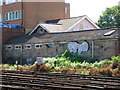
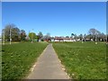
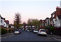
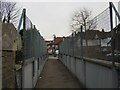
Photos of BN3 6ND
Area Information
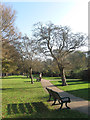
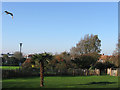
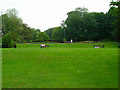
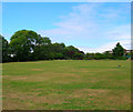
BN3 6ND is a small, densely populated residential postcode area in England, covering just 5.9 hectares and home to 1,651 residents. Situated in the Westdene & Hove Park ward, it lies within a historically agricultural region transformed into suburban housing in the 1920s and 1930s. The area’s compact size means it is closely integrated with nearby amenities, from retail hubs to green spaces. Its proximity to Hove Park, a 39-acre public park with historical features like the Goldstone stone and original tennis courts, offers residents easy access to leisure and recreation. The ward, formed in 2023 by merging parts of Withdean and Hove Park, reflects a blend of older suburban development and modern infrastructure. With a population density of 28,196 people per square kilometre, the area is characterised by a tight-knit community, where daily life revolves around local shops, schools, and transport links. For buyers, BN3 6ND represents a compact, family-friendly environment with a strong sense of place.
- Area Type
- Postcode
- Area Size
- 5.9 hectares
- Population
- Not available
- Population Density
- Not available
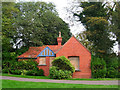
The property market in BN3 6ND is dominated by owner-occupied homes, with 82% of households owning their properties. This high rate of home ownership suggests a stable, long-term resident base rather than a rental market. The accommodation type is primarily houses, which is typical of suburban areas with larger plots. Given the postcode’s small size (5.9 hectares), the housing stock is limited, making the area potentially competitive for buyers. The focus on owner-occupied properties may indicate a preference for family homes, though the absence of data on property prices or recent sales trends means the market’s affordability and demand cannot be fully assessed. For buyers, the area’s compact nature means proximity to amenities is a key advantage, though the limited housing supply could lead to higher prices. Those seeking a settled, low-turnover environment with established housing may find BN3 6ND appealing.
House Prices in BN3 6ND
No properties found in this postcode.
Energy Efficiency in BN3 6ND
Daily life in BN3 6ND is shaped by its proximity to key amenities. Within practical reach are five retail outlets, including Tesco Hove Dyke and Tesco Hove, ensuring access to groceries and household goods. The area’s rail links, with stations like Hove and London Road, connect residents to the wider region, while nearby airports offer regional travel options. The presence of Hove Park, a historic 39-acre public space, adds a green dimension to the lifestyle, with facilities like tennis courts and bowling greens. Though the area is small, its density means residents are close to shops, transport, and recreational spaces. The mix of retail, transport, and greenery supports a convenient, active lifestyle, blending suburban comfort with urban accessibility.
Amenities
Schools
BN3 6ND is served by a range of schools, including Cottesmore St Mary’s Catholic Primary School (Ofsted rating: good) and Cardinal Newman Catholic School (Ofsted rating: outstanding), both primary institutions. For independent education, Lancing College Preparatory School At Hove offers an alternative to state-funded options. At the secondary level, Brighton Hove and Sussex Sixth Form College provides sixth-form education. The mix of school types ensures families have choices, from high-performing state schools to private institutions. The presence of an outstanding primary school suggests strong foundational education, while the sixth-form college caters to older students. This variety supports both local and broader educational needs, making the area attractive to families prioritising school quality. However, the absence of data on school catchment areas or pupil numbers means the full impact on the community remains unclear.
| Rank | School | Type | Entry gender | Ages |
|---|
Explore more schools in this area
Go to Schools tabDemographics
BN3 6ND has a median age of 47, with the majority of residents aged between 30 and 64. This suggests a community skewed towards middle-aged adults, likely reflecting a mix of long-term residents and families. Home ownership is high, with 82% of households owning their homes, indicating a stable, established population. The accommodation type is predominantly houses, which aligns with the area’s suburban character. The predominant ethnic group is White, though no specific diversity statistics are provided. The absence of detailed data on deprivation or socio-economic breakdown means the area’s quality of life can only be inferred from ownership rates and age distribution. The high home ownership and mature age profile suggest a low turnover of residents, fostering a sense of continuity. However, without further data on income levels or household composition, a fuller picture of the community’s dynamics remains elusive.
Household Size
Accommodation Type
Tenure
Ethnic Group
Religion
Household Composition
Age
Household Deprivation
NS-SEC
Explore more demographic insights in this area
Go to Demographics tabPlanning
Planning Constraints
- Flood RiskPremium
- Ramsar Wetland SitesPremium
- Area of Outstanding Natural BeautyPremium
- Protected Nature ReservePremium
- Protected WoodlandPremium