Area Overview for BN3 6HD
Photos of BN3 6HD
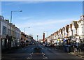
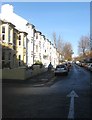
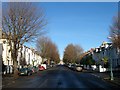
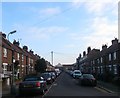
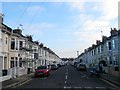
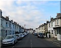
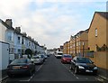
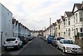
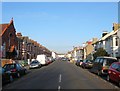
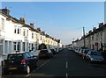
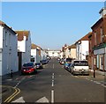
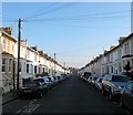
100 photos from this area
Area Information
Key information about the BN3 6HD including its size, population, and administrative classification.
- Area Type
- Postcode
- Area Size
- 9437 m²
- Population
- 1850
- Population Density
- 8215 people/km²
House Prices in BN3 6HD
54
Properties
£451,858
Average Sold Price
£85,000
Lowest Price
£850,000
Highest Price
Showing 54 properties
| Address | Type | Beds | Baths | Last Sale Price | Last Sale Date | |
|---|---|---|---|---|---|---|
| 38 Fonthill Road, Hove, BN3 6HD | Bungalow | 1 | 1 | £610,000 | Nov 2024 | |
| 78 Fonthill Road, Hove, BN3 6HD | Terraced | 4 | 2 | £800,180 | Feb 2023 | |
| 20 Fonthill Road, Hove, BN3 6HD | Semi-detached | 4 | - | £620,000 | Jun 2022 | |
| 60 Fonthill Road, Hove, BN3 6HD | house | 5 | 2 | £850,000 | Oct 2021 | |
| 14 Fonthill Road, Hove, BN3 6HD | Flat | 2 | 1 | £530,000 | Nov 2020 | |
| 50 Fonthill Road, Hove, BN3 6HD | Semi-detached | 4 | - | £785,000 | Sep 2020 | |
| 48 Fonthill Road, Hove, BN3 6HD | Flat | 2 | 1 | £575,000 | Sep 2019 | |
| 68 Fonthill Road, Hove, BN3 6HD | Terraced | 5 | 2 | £677,000 | Nov 2018 | |
| 72 Fonthill Road, Hove, BN3 6HD | Terraced | 4 | 1 | £697,000 | Oct 2017 | |
| 26 Fonthill Road, Hove, BN3 6HD | Terraced | 3 | - | £442,000 | Jan 2015 |
Page 1 of 6
Energy Efficiency in BN3 6HD
Amenities
Schools
| Rank | School | Type | Entry gender | Ages |
|---|
Explore more schools in this area
Go to Schools tabDemographics
Household Size
One person
most common
Accommodation Type
Flats
most common
Tenure
57
majority
Ethnic Group
White
most common
Religion
N/A
most common
Household Composition
N/A
most common
Age
47
median
Adults (30-64 years)
most common
Household Deprivation
N/A
with no deprivation
NS-SEC
49
in Lower managerial occupations
Explore more demographic insights in this area
Go to Demographics tabPlanning
Planning Constraints
- Flood RiskPremium
- Ramsar Wetland SitesPremium
- Area of Outstanding Natural BeautyPremium
- Protected Nature ReservePremium
- Protected WoodlandPremium