Area Overview for BN3 6GW
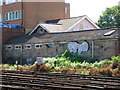
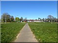
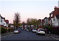
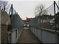
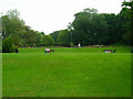
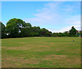
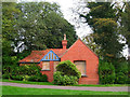
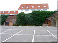
Photos of BN3 6GW
Area Information
BN3 6GW is a small residential cluster within Brighton and Hove, a town known for its coastal charm and historic architecture. With a population of 1,767, the area is compact but well-served by nearby amenities. Its origins trace back to the 19th century, when Baron Isaac Lyon Goldsmid acquired the Wick estate, later developing Grade I listed buildings like Adelaide Crescent and Palmeira Square. Today, the area retains a quiet, residential character, blending historical significance with modern convenience. Residents benefit from proximity to multiple railway stations, including Hove and Aldrington, offering easy access to Brighton’s city centre and beyond. Nearby, shops such as Tesco Hove and Co-op Blatchington provide daily essentials, while two airports—Shoreham Brighton City and Shoreham—cater to regional travel needs. The area’s median age of 47 suggests a stable, mature community, with many residents in their prime working years. For those seeking a balance between tranquillity and accessibility, BN3 6GW offers a distinct blend of heritage and practicality, ideal for those prioritising safety, connectivity, and a low-crime environment.
- Area Type
- Postcode
- Area Size
- Not available
- Population
- Not available
- Population Density
- Not available
The property market in BN3 6GW is characterised by a 34% home ownership rate, suggesting that the majority of residents are renters rather than homeowners. This aligns with the area’s predominant accommodation type: flats. Given the small population and compact nature of the postcode, the housing stock is likely limited to a few residential blocks or converted buildings, possibly including the historic Grade I listed structures from the 19th century. The low home ownership rate may indicate a rental market driven by local workers or students, though the lack of specific data on property prices or availability makes it difficult to assess investment potential. Buyers considering the area should note the limited scope for expansion, as the small residential cluster may not offer extensive options for purchase. Those seeking flats in a low-crime, well-connected area may find BN3 6GW appealing, but the market’s dynamics are best understood through direct engagement with local agents or property listings.
House Prices in BN3 6GW
No properties found in this postcode.
Energy Efficiency in BN3 6GW
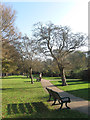
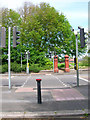
Living in BN3 6GW offers a mix of convenience and local character, with amenities within easy reach. Retail options include Tesco Hove, Co-op Blatchington, and Budgens Church, providing essential shopping for daily needs. The proximity to Hove Railway Station, Aldrington, and Preston Park stations ensures quick access to Brighton’s cultural and commercial centres, while the two nearby airports—Shoreham Brighton City and Shoreham—open up regional travel opportunities. Though the area is small, its connectivity to larger hubs means residents can enjoy both quiet living and urban access. The presence of historic sites like Adelaide Crescent and Palmeira Square adds a unique aesthetic to the neighbourhood. For leisure, the area’s low crime rate and lack of environmental constraints make it suitable for outdoor activities, though specific parks or recreational spaces are not detailed in the data. Overall, BN3 6GW balances practicality with a sense of community, offering a lifestyle that prioritises accessibility without sacrificing a sense of place.
Amenities
Schools
| Rank | School | Type | Entry gender | Ages |
|---|
Explore more schools in this area
Go to Schools tabDemographics
BN3 6GW has a median age of 47, with the majority of residents aged between 30 and 64. This reflects a mature, established community, likely comprising professionals and families in their prime working years. Home ownership in the area is relatively low at 34%, indicating that a significant proportion of residents rent their homes. The predominant accommodation type is flats, suggesting a mix of older, purpose-built housing and modern developments. The predominant ethnic group is White, though specific data on diversity or deprivation is not provided. The low crime risk score of 79/100 highlights a safer neighbourhood compared to national averages, which may appeal to those prioritising security. The absence of protected natural sites or flood risks further supports a stable living environment. However, the limited data on household composition or income levels means broader insights into the community’s socioeconomic profile remain unexplored.
Household Size
Accommodation Type
Tenure
Ethnic Group
Religion
Household Composition
Age
Household Deprivation
NS-SEC
Explore more demographic insights in this area
Go to Demographics tabPlanning
Planning Constraints
- Flood RiskPremium
- Ramsar Wetland SitesPremium
- Area of Outstanding Natural BeautyPremium
- Protected Nature ReservePremium
- Protected WoodlandPremium