Area Overview for BN3 6FW
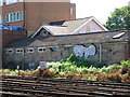
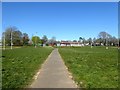
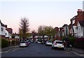
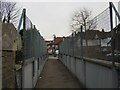
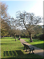
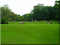
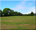
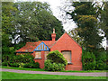
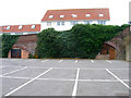
Photos of BN3 6FW
Area Information
BN3 6FW is a small residential cluster in the heart of Brighton and Hove, a town known for its coastal charm and vibrant urban life. With a population of 1,850, it is a tight-knit community characterised by its historical roots. Named after Baron Isaac Lyon Goldsmid, who owned the Wick estate in the 19th century, the area features Grade I listed buildings like Adelaide Crescent and Palmeira Square. This postcode lies within the Goldsmid electoral ward, a district that blends historic architecture with modern living. Daily life here is shaped by its proximity to Brighton’s cultural and commercial hubs, yet it retains a quiet, residential feel. The area is home to a mature population, with a median age of 47, and a majority of residents are homeowners. Its compact size means amenities and transport links are within easy reach, making it appealing to those seeking a balance between convenience and tranquillity.
- Area Type
- Postcode
- Area Size
- Not available
- Population
- 1850
- Population Density
- 8215 people/km²
The property market in BN3 6FW is defined by its concentration of flats, with 57% of residents owning their homes. This suggests a mix of owner-occupied and rental properties, though the exact split of the latter is not specified. The presence of flats indicates a focus on medium-density housing, which is typical for urban areas with limited space. Given the area’s small size, the housing stock is likely compact, with limited scope for expansion. For buyers, this means a niche market with a strong emphasis on flats, possibly appealing to those prioritising location over property size. The proximity to Brighton’s amenities may enhance the area’s desirability, though the small postcode area means competition for properties is likely to be high.
House Prices in BN3 6FW
No properties found in this postcode.
Energy Efficiency in BN3 6FW
Living in BN3 6FW offers access to a range of amenities within easy reach. Retail options include Tesco Hove, Lidl Brighton Gold, and other local shops, ensuring daily necessities are readily available. The area’s proximity to Hove Railway Station and Preston Park Station connects residents to Brighton’s cultural and commercial districts, while nearby airports provide regional travel opportunities. Although the data does not specify parks or leisure facilities, the area’s small size suggests a compact lifestyle where amenities are concentrated. The presence of multiple retail outlets and transport links enhances convenience, supporting a lifestyle that balances local convenience with access to broader opportunities.
Amenities
Schools
The nearest school to BN3 6FW is Drive Preparatory School, an independent institution with an Ofsted rating of inadequate. This single school option highlights a limited range of educational choices for families. The absence of state schools in the immediate vicinity means parents may need to consider nearby areas for alternative schooling. Drive Preparatory’s rating suggests potential concerns about educational quality, though specific performance metrics are not provided. Families prioritising independent education may find this school suitable, but those seeking state-funded options will need to look further afield. The lack of nearby schools with higher Ofsted ratings could be a critical factor for prospective buyers.
| Rank | School | Type | Entry gender | Ages |
|---|
Explore more schools in this area
Go to Schools tabDemographics
The community in BN3 6FW is predominantly composed of adults aged 30–64, reflecting a mature demographic with a median age of 47. Home ownership is strong, with 57% of residents owning their homes, while the remaining properties are likely rented. The accommodation type is primarily flats, indicating a mix of purpose-built and converted housing. The predominant ethnic group is White, though specific data on diversity is not provided. This age profile suggests a stable, established population, potentially with families and professionals. The low deprivation levels implied by the data align with the area’s proximity to services and infrastructure. However, the lack of detailed diversity statistics means the full range of community experiences cannot be fully quantified.
Household Size
Accommodation Type
Tenure
Ethnic Group
Religion
Household Composition
Age
Household Deprivation
NS-SEC
Explore more demographic insights in this area
Go to Demographics tabPlanning
Planning Constraints
- Flood RiskPremium
- Ramsar Wetland SitesPremium
- Area of Outstanding Natural BeautyPremium
- Protected Nature ReservePremium
- Protected WoodlandPremium