Area Overview for BN3 5SG
Photos of BN3 5SG
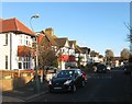
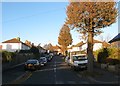
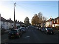
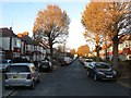
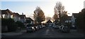
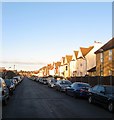
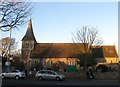
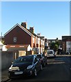
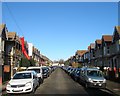
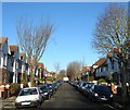
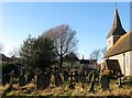
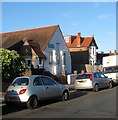
100 photos from this area
Area Information
Key information about the BN3 5SG including its size, population, and administrative classification.
- Area Type
- Postcode
- Area Size
- 1.3 hectares
- Population
- Not available
- Population Density
- Not available
House Prices in BN3 5SG
36
Properties
£416,821
Average Sold Price
£210,000
Lowest Price
£820,000
Highest Price
Showing 36 properties
| Address | Type | Beds | Baths | Last Sale Price | Last Sale Date | |
|---|---|---|---|---|---|---|
| 385A Portland Road, Hove, BN3 5SG | Flat | 2 | 1 | £376,000 | Feb 2025 | |
| 381 Portland Road, Hove, BN3 5SG | Semi-detached | 2 | 1 | £415,000 | Aug 2024 | |
| 407 Portland Road, Hove, BN3 5SG | Semi-detached | 6 | 1 | £820,000 | May 2023 | |
| 397 Portland Road, Hove, BN3 5SG | Detached | 5 | 2 | £735,000 | Mar 2022 | |
| 383 Portland Road, Hove, BN3 5SG | house | 2 | - | £365,000 | Mar 2021 | |
| 403 Portland Road, Hove, BN3 5SG | house | - | - | £625,000 | Mar 2021 | |
| 411 Portland Road, Hove, BN3 5SG | house | - | - | £535,000 | Dec 2020 | |
| 387 Portland Road, Hove, BN3 5SG | Flat | 5 | 1 | £458,000 | Jun 2015 | |
| 379 Portland Road, Hove, BN3 5SG | house | 2 | - | £242,500 | Sep 2013 | |
| 375 Portland Road, Hove, BN3 5SG | house | - | - | £250,000 | Apr 2013 |
Page 1 of 4
Energy Efficiency in BN3 5SG
Amenities
Schools
| Rank | School | Type | Entry gender | Ages |
|---|
Explore more schools in this area
Go to Schools tabDemographics
Household Size
Family (3-5 people)
most common
Accommodation Type
Houses
most common
Tenure
72
majority
Ethnic Group
White
most common
Religion
N/A
most common
Household Composition
N/A
most common
Age
47
median
Adults (30-64 years)
most common
Household Deprivation
N/A
with no deprivation
NS-SEC
48
in Lower managerial occupations
Explore more demographic insights in this area
Go to Demographics tabPlanning
Planning Constraints
- Flood RiskPremium
- Ramsar Wetland SitesPremium
- Area of Outstanding Natural BeautyPremium
- Protected Nature ReservePremium
- Protected WoodlandPremium