Area Overview for BN3 5LW
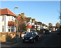
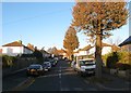
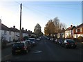
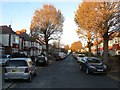
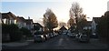
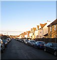
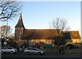
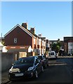
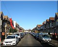
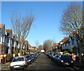
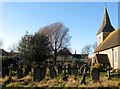
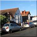
Photos of BN3 5LW
Area Information
BN3 5LW is a small residential postcode area in the city of Hove, part of the Brighton and Hove unitary authority. With a population of 1,668, it is a compact cluster of homes, predominantly owner-occupied and largely composed of houses. The area sits within the Hove and Portslade parliamentary constituency, offering proximity to the coastal town of Brighton and the broader South East region. Daily life here is shaped by its quiet residential character, with a median age of 47 and a population skewed toward adults aged 30–64. The presence of independent schools like The Fold School and Deepdene School suggests a focus on private education, while nearby amenities such as Portslade Railway Station and retail outlets like Aldi and Iceland provide practical convenience. Though small, the area’s proximity to major transport hubs and its low crime risk make it an appealing choice for those seeking a settled, family-friendly environment.
- Area Type
- Postcode
- Area Size
- Not available
- Population
- Not available
- Population Density
- Not available
BN3 5LW is primarily an owner-occupied area, with 72% of homes owned by residents rather than rented. The accommodation type is predominantly houses, which suggests a more traditional, family-oriented housing stock. This contrasts with areas where flats or apartments dominate, and it aligns with the area’s mature demographic profile. The small size of the postcode area means the housing stock is limited, but the high home ownership rate indicates a stable market with long-term residents. For buyers, this implies a focus on established properties rather than new developments. The absence of rental properties may make the area less attractive to those seeking short-term tenancies, but it offers security for those prioritising ownership. The presence of houses also suggests potential for larger living spaces, which could appeal to growing families.
House Prices in BN3 5LW
No properties found in this postcode.
Energy Efficiency in BN3 5LW
BN3 5LW offers a mix of practical amenities within reach, enhancing daily life for residents. The area’s rail stations, including Portslade and Aldrington, provide easy access to commuting and regional travel. Retail options such as Aldi, Iceland, and The Southern Co-operative Co cater to everyday shopping needs, while the presence of two airports nearby adds to the area’s connectivity. Though the postcode itself is small, its location within Hove and Portslade means residents can access the broader amenities of Brighton, including coastal attractions and cultural hubs. The availability of independent schools and a low crime risk further contribute to a lifestyle that balances convenience with a sense of security. The compact nature of the area ensures that essential services are within walking or short driving distance, fostering a self-contained yet connected community.
Amenities
Schools
The Fold School and Deepdene School are the two independent schools nearest to BN3 5LW. Both are private institutions, offering an alternative to state education. The presence of two independent schools in the area may indicate a community with a strong preference for private schooling, though the data does not include Ofsted ratings or academic performance metrics. Families seeking independent education will find these schools within practical reach, though they may require additional commuting for younger children. The absence of state schools in the immediate vicinity could be a consideration for those prioritising public education options. Nonetheless, the availability of private schooling adds to the area’s appeal for households valuing choice and specialised curricula.
| Rank | School | Type | Entry gender | Ages |
|---|
Explore more schools in this area
Go to Schools tabDemographics
The population of BN3 5LW is predominantly adults aged 30–64, with a median age of 47. Home ownership is high, at 72%, and the area is characterised by a predominance of houses rather than flats. The predominant ethnic group is White, though the data does not specify further diversity metrics. This demographic profile suggests a mature, stable community with a focus on long-term residency. The low median age, combined with high home ownership, indicates a population likely composed of established families and professionals. With no data on deprivation levels, the area’s quality of life appears underpinned by its safety, connectivity, and access to amenities. The absence of significant age groups such as young children or retirees may reflect a community in transition or one that prioritises middle-aged households.
Household Size
Accommodation Type
Tenure
Ethnic Group
Religion
Household Composition
Age
Household Deprivation
NS-SEC
Explore more demographic insights in this area
Go to Demographics tabPlanning
Planning Constraints
- Flood RiskPremium
- Ramsar Wetland SitesPremium
- Area of Outstanding Natural BeautyPremium
- Protected Nature ReservePremium
- Protected WoodlandPremium