Area Overview for BN3 4LB
Photos of BN3 4LB
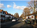
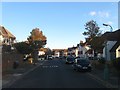
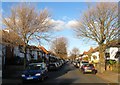
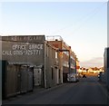
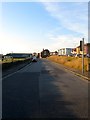
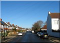

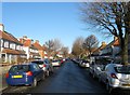
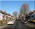
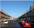
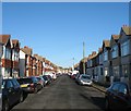
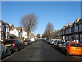
100 photos from this area
Area Information
Key information about the BN3 4LB including its size, population, and administrative classification.
- Area Type
- Postcode
- Area Size
- 1.1 hectares
- Population
- 1766
- Population Density
- 3915 people/km²
House Prices in BN3 4LB
42
Properties
£622,123
Average Sold Price
£109,938
Lowest Price
£1,100,000
Highest Price
Showing 42 properties
| Address | Type | Beds | Baths | Last Sale Price | Last Sale Date | |
|---|---|---|---|---|---|---|
| 59 Roman Road, Hove, BN3 4LB | Semi-detached | 3 | 1 | £848,272 | Mar 2025 | |
| 17 Roman Road, Hove, BN3 4LB | Semi-detached | 4 | 2 | £1,100,000 | Jan 2025 | |
| 49 Roman Road, Hove, BN3 4LB | Semi-detached | 4 | 2 | £980,000 | Dec 2024 | |
| 13 Roman Road, Hove, BN3 4LB | house | 5 | 3 | £810,000 | Aug 2023 | |
| 57 Roman Road, Hove, BN3 4LB | house | - | - | £615,000 | Jan 2020 | |
| 15 Roman Road, Hove, BN3 4LB | Semi-detached | 4 | 3 | £800,000 | Oct 2019 | |
| 23 Roman Road, Hove, BN3 4LB | Semi-detached | 4 | 4 | £780,000 | Sep 2019 | |
| 7 Roman Road, Hove, BN3 4LB | house | 3 | 2 | £765,000 | Aug 2019 | |
| 31 Roman Road, Hove, BN3 4LB | house | - | - | £670,000 | Nov 2018 | |
| 37 Roman Road, Hove, BN3 4LB | house | 4 | 2 | £780,000 | Jul 2018 |
Page 1 of 5
Energy Efficiency in BN3 4LB
Amenities
Schools
| Rank | School | Type | Entry gender | Ages |
|---|
Explore more schools in this area
Go to Schools tabDemographics
Household Size
Family (3-5 people)
most common
Accommodation Type
Houses
most common
Tenure
77
majority
Ethnic Group
White
most common
Religion
N/A
most common
Household Composition
N/A
most common
Age
47
median
Adults (30-64 years)
most common
Household Deprivation
N/A
with no deprivation
NS-SEC
52
in Lower managerial occupations
Explore more demographic insights in this area
Go to Demographics tabPlanning
Planning Constraints
- Flood RiskPremium
- Ramsar Wetland SitesPremium
- Area of Outstanding Natural BeautyPremium
- Protected Nature ReservePremium
- Protected WoodlandPremium