Area Overview for BN3 4EL
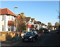
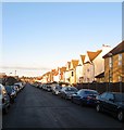
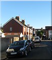
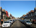
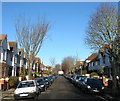
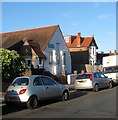
Photos of BN3 4EL


Area Information
BN3 4EL is a small, tightly knit residential area in Hove, part of the Brighton and Hove unitary authority. With a population of 1,723, it sits within the Wish electoral ward, a community known for its quiet, suburban character. The area is defined by its compact size, offering a balance between residential comfort and proximity to key services. Residents benefit from nearby rail networks, including Portslade and Aldrington stations, which provide easy access to Brighton and surrounding towns. The area’s demographics suggest a mature, stable community, with a median age of 47 and a majority of residents aged 30–64. This reflects a mix of long-term residents and families, with homes predominantly owner-occupied. Daily life here is shaped by the availability of local shops, such as Tesco Portslade and Aldi Portslade, and the presence of two nearby airports, making it convenient for travel. While small, BN3 4EL offers a sense of security, with low crime risk and no significant environmental constraints, creating a practical, low-maintenance lifestyle for those seeking a settled, community-focused environment.
- Area Type
- Postcode
- Area Size
- Not available
- Population
- 1723
- Population Density
- 11418 people/km²
The property market in BN3 4EL is characterised by a 56% home ownership rate, indicating a majority of owner-occupied properties. The accommodation type is predominantly houses, which suggests a focus on family homes and larger properties. This contrasts with areas dominated by flats or apartments, making BN3 4EL more suitable for those prioritising space and private outdoor areas. The small size of the area means the housing stock is limited, which could lead to competition among buyers. For those seeking rental properties, the lower home ownership rate implies a smaller proportion of the market is available for let, potentially increasing demand for available units. The presence of houses also means the area may cater more to long-term residents rather than transient renters. Buyers should consider the compact nature of the postcode when exploring nearby areas, as the immediate surroundings may offer similar housing types and constraints.
House Prices in BN3 4EL
No properties found in this postcode.
Energy Efficiency in BN3 4EL
Living in BN3 4EL offers access to a range of amenities within practical reach. The area is served by five retail outlets, including major names like Tesco Portslade, Iceland Portslade, and Aldi Portslade, ensuring everyday shopping needs are met locally. Three rail stations—Portslade, Fishersgate, and Aldrington—provide frequent connections to Brighton and surrounding areas, enhancing mobility. Two nearby airports, Shoreham Brighton City Airport and Shoreham Airport, cater to those requiring air travel. While the area is small, its proximity to these services suggests a balance between suburban tranquillity and urban convenience. The presence of retail and transport hubs implies a functional, community-focused lifestyle, where residents can access essentials without needing to travel far. This mix of amenities supports both daily routines and occasional leisure, contributing to a practical, well-connected living environment.
Amenities
Schools
| Rank | School | Type | Entry gender | Ages |
|---|
Explore more schools in this area
Go to Schools tabDemographics
BN3 4EL has a median age of 47, with the largest age group being adults aged 30–64. This indicates a community of mostly middle-aged residents, many of whom may be established professionals or families. Home ownership stands at 56%, suggesting a mix of owner-occupied properties and rental homes. The area is predominantly composed of houses, reflecting a traditional, family-oriented housing stock. The predominant ethnic group is White, which aligns with broader demographic trends in the region. With a population of 1,723, the area is small enough to foster a close-knit community but large enough to support essential services. The absence of specific data on deprivation means no direct commentary on economic challenges, but the high home ownership rate and stable age profile suggest a relatively secure, middle-income demographic. This profile may appeal to buyers seeking a stable, low-risk environment with established infrastructure.
Household Size
Accommodation Type
Tenure
Ethnic Group
Religion
Household Composition
Age
Household Deprivation
NS-SEC
Explore more demographic insights in this area
Go to Demographics tabPlanning
Planning Constraints
- Flood RiskPremium
- Ramsar Wetland SitesPremium
- Area of Outstanding Natural BeautyPremium
- Protected Nature ReservePremium
- Protected WoodlandPremium