Area Overview for BN3 3ZA
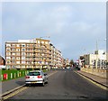
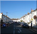
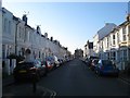
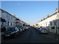
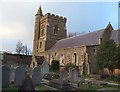
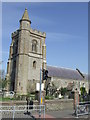
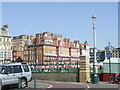
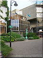
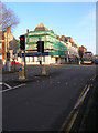
Photos of BN3 3ZA


Area Information
Living in BN3 3ZA means being part of a tightly knit residential cluster in the heart of Central Hove, a ward within Brighton and Hove City Council. The area spans 418 square metres and is home to 1,576 residents, creating a densely populated yet compact community. Its location within the BN3 postcode area places it at the intersection of urban convenience and proximity to key infrastructure. Church Road, a defining feature of Central Hove, runs through the area, lined with restaurants, cafes, pubs, and bars that contribute to a lively local atmosphere. This small postcode is part of the Hove and Portslade parliamentary constituency, with two councillors representing the ward. Daily life here is shaped by its proximity to retail hubs, rail networks, and two nearby airports, making it a practical choice for those balancing urban living with accessibility. The area’s character is defined by its mix of residential flats, a 30% home ownership rate, and a predominantly White population, reflecting a community that is both established and evolving.
- Area Type
- Postcode
- Area Size
- 418 m²
- Population
- 1576
- Population Density
- 12669 people/km²
The property market in BN3 3ZA is characterised by a 30% home ownership rate, indicating that most residents are renters rather than homeowners. The accommodation type is predominantly flats, reflecting the area’s small size and urban layout. This suggests a housing stock that is largely purpose-built for rental purposes, with limited scope for owner-occupied properties. The compact nature of the postcode means that buyers considering BN3 3ZA must evaluate the immediate surroundings for additional housing options. The high population density and proximity to amenities like retail centres and rail stations make it attractive for those prioritising convenience over space. However, the limited availability of owner-occupied homes may pose challenges for buyers seeking long-term investment. The area’s property landscape is thus best suited for those looking for short-term rental solutions or proximity to urban services rather than expansive residential plots.
House Prices in BN3 3ZA
No properties found in this postcode.
Energy Efficiency in BN3 3ZA
The lifestyle in BN3 3ZA is shaped by its proximity to a range of amenities. Retail options include major chains such as Tesco Hove, Sainsburys Hove, and Co-op Blatchington, ensuring daily shopping needs are met within walking distance. Church Road, the area’s main thoroughfare, is lined with restaurants, cafes, pubs, and bars, offering a vibrant dining and social scene. The nearby rail stations—Hove, Aldrington, and Preston Park—provide efficient commuting options, while the two airports within reach cater to travel demands. Though the area lacks expansive parks or green spaces, its compact design ensures that essential services are within easy reach. This blend of retail, dining, and transport infrastructure creates a convenient, fast-paced lifestyle ideal for those prioritising accessibility over large-scale leisure facilities.
Amenities
Schools
| Rank | School | Type | Entry gender | Ages |
|---|
Explore more schools in this area
Go to Schools tabDemographics
The population of BN3 3ZA is 1,576, with a median age of 47, indicating a mature demographic skewed towards adults aged 30–64. This age range suggests a community of professionals, families, and retirees, though the 30% home ownership rate points to a rental-heavy market. The accommodation type is predominantly flats, which aligns with the area’s compact footprint and the typical housing stock in urban centres. The predominant ethnic group is White, reflecting broader trends in the region. While specific data on deprivation is absent, the high population density of 3,774,582 people per square kilometre implies a mix of socioeconomic profiles. This density, combined with the age distribution, suggests a community that is active, interconnected, and reliant on local amenities for daily needs. The absence of protected natural areas or planning constraints further underscores the area’s focus on residential and commercial infrastructure over environmental preservation.
Household Size
Accommodation Type
Tenure
Ethnic Group
Religion
Household Composition
Age
Household Deprivation
NS-SEC
Explore more demographic insights in this area
Go to Demographics tabPlanning
Planning Constraints
- Flood RiskPremium
- Ramsar Wetland SitesPremium
- Area of Outstanding Natural BeautyPremium
- Protected Nature ReservePremium
- Protected WoodlandPremium